Approximate Location Map
Large Map »
Latitude: 51.7436 / 51°44'37"N
Longitude: -2.2089 / 2°12'32"W
OS Eastings: 385672
OS Northings: 205012
OS Grid: SO856050
Mapcode National: GBR 1ML.LC9
Mapcode Global: VH94Y.NFLP
Plus Code: 9C3VPQVR+FC
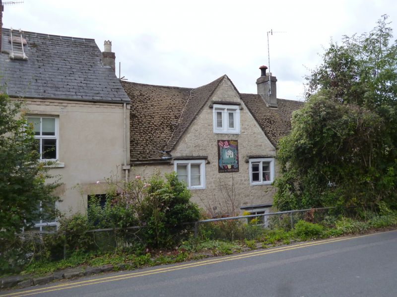
Entry Name: 9-11, Whitehall
Listing Date: 1 May 1951
Grade: II
Source: Historic England
Source ID: 1223462
English Heritage Legacy ID: 419195
ID on this website: 101223462
Location: Stroud Hill, Stroud, Gloucestershire, GL5
County: Gloucestershire
District: Stroud
Civil Parish: Stroud
Built-Up Area: Stroud
Traditional County: Gloucestershire
Lieutenancy Area (Ceremonial County): Gloucestershire
Church of England Parish: Stroud Holy Trinity
Church of England Diocese: Gloucester
Tagged with: Building
1. WHITEHALL
5227
(South Side)
Nos 9 to 11 (consec)
SO 8505 5/17 1.5.51.
II GV
2.
C17. Painted rubble. Cotswold stone roof. 3 storeys. Various 2-light mullion
windows with dripmoulds, or casement windows.
Nos 9 to 13 (consec) form a group.
Listing NGR: SO8567205012
External links are from the relevant listing authority and, where applicable, Wikidata. Wikidata IDs may be related buildings as well as this specific building. If you want to add or update a link, you will need to do so by editing the Wikidata entry.


Other nearby listed buildings
