Approximate Location Map
Large Map »
Latitude: 51.2722 / 51°16'19"N
Longitude: 0.5207 / 0°31'14"E
OS Eastings: 575931
OS Northings: 155579
OS Grid: TQ759555
Mapcode National: GBR PR7.0H7
Mapcode Global: VHJMD.Z952
Plus Code: 9F327GCC+V7
Entry Name: 16-20, Mill Street
Listing Date: 2 August 1974
Grade: II
Source: Historic England
Source ID: 1224837
English Heritage Legacy ID: 173429
ID on this website: 101224837
Location: Maidstone, Kent, ME15
County: Kent
District: Maidstone
Electoral Ward/Division: High Street
Parish: Non Civil Parish
Built-Up Area: Maidstone
Traditional County: Kent
Lieutenancy Area (Ceremonial County): Kent
Tagged with: Building
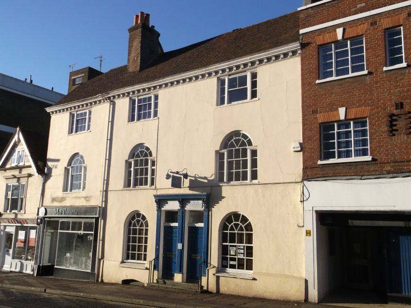
MILL STREET
1.
5278
(West Side)
Nos 16 to 20 (even)
TQ 7555 NE 1/66
II GV
2.
3 C18 houses refaced with cement. 3 storeys. Tiled roof with wooden modillion
eaves cornice. 3 triple sashes with glazing bars intact. These are modified
Venetian windows on the lst floot. Modern shop fronts. No 18 has an internal
doorcase with elliptical fanlight and reeded pilasters.
Nos 16 to 22 (even) form a group.
Listing NGR: TQ7592855582
External links are from the relevant listing authority and, where applicable, Wikidata. Wikidata IDs may be related buildings as well as this specific building. If you want to add or update a link, you will need to do so by editing the Wikidata entry.


Other nearby listed buildings
