Approximate Location Map
Large Map »
Latitude: 53.6515 / 53°39'5"N
Longitude: -1.8084 / 1°48'30"W
OS Eastings: 412764
OS Northings: 417240
OS Grid: SE127172
Mapcode National: GBR HVT6.9R
Mapcode Global: WHCB1.6H41
Plus Code: 9C5WM52R+JM
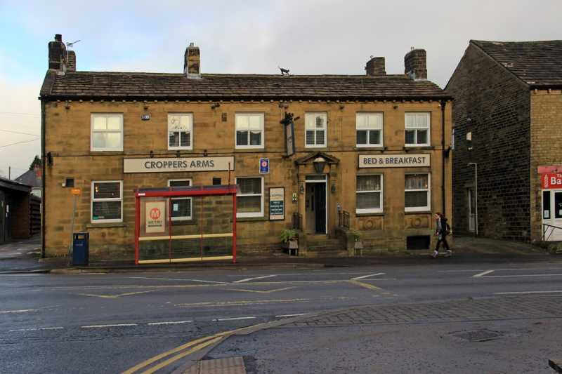
Entry Name: The Croppers Arms
Listing Date: 29 September 1978
Grade: II
Source: Historic England
Source ID: 1224849
English Heritage Legacy ID: 421005
ID on this website: 101224849
Location: Marsh, Kirklees, West Yorkshire, HD1
County: Kirklees
Electoral Ward/Division: Greenhead
Parish: Non Civil Parish
Built-Up Area: Huddersfield
Traditional County: Yorkshire
Lieutenancy Area (Ceremonial County): West Yorkshire
Church of England Parish: Huddersfield Holy Trinity
Church of England Diocese: Leeds
Tagged with: Pub
WESTBOURNE ROAD
1.
5113
(North Side)
Marsh Fold
The Croppers Arms
SE 1217 27/1369
II
2.
Mid C19. Ashlar. Pitched stone slate roof. 2 storeys. Stone brackets to
gutter. Band. 6 ranges of sashes. Door with Tuscan pilasters taking fluted
brackets to open triangular pediment.
Listing NGR: SE1276417240
External links are from the relevant listing authority and, where applicable, Wikidata. Wikidata IDs may be related buildings as well as this specific building. If you want to add or update a link, you will need to do so by editing the Wikidata entry.


Other nearby listed buildings
