Approximate Location Map
Large Map »
Latitude: 51.4895 / 51°29'22"N
Longitude: -0.164 / 0°9'50"W
OS Eastings: 527564
OS Northings: 178323
OS Grid: TQ275783
Mapcode National: GBR 7N.C7
Mapcode Global: VHGQZ.3TNJ
Plus Code: 9C3XFRQP+Q9
Entry Name: 138A, Kings Road SW3
Listing Date: 15 April 1969
Grade: II
Source: Historic England
Source ID: 1225025
English Heritage Legacy ID: 420867
ID on this website: 101225025
Location: Chelsea, Kensington and Chelsea, London, SW3
County: London
District: Kensington and Chelsea
Electoral Ward/Division: Royal Hospital
Parish: Non Civil Parish
Built-Up Area: Kensington and Chelsea
Traditional County: Middlesex
Lieutenancy Area (Ceremonial County): Greater London
Church of England Parish: St Luke and Christ Church Chelsea
Church of England Diocese: London
Tagged with: Building
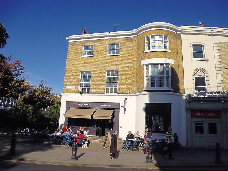
TQ 2778 SE KING'S ROAD SW3
57/6 (north side)
15.4.69 No 138A
GV II
House. Early C19. Brick. Three storeys. Bow window full height to right hand side. Three bays. Sash windows. Group value.
External links are from the relevant listing authority and, where applicable, Wikidata. Wikidata IDs may be related buildings as well as this specific building. If you want to add or update a link, you will need to do so by editing the Wikidata entry.


Other nearby listed buildings
