Approximate Location Map
Large Map »
Latitude: 51.2707 / 51°16'14"N
Longitude: 0.5216 / 0°31'17"E
OS Eastings: 575998
OS Northings: 155415
OS Grid: TQ759554
Mapcode National: GBR PR7.6QC
Mapcode Global: VHJMF.0B36
Plus Code: 9F327GCC+7J
Entry Name: Parish Church of All Saints
Listing Date: 30 July 1951
Grade: I
Source: Historic England
Source ID: 1225056
English Heritage Legacy ID: 173439
Also known as: All Saints Church, Maidstone
ID on this website: 101225056
Location: All Saints' Church, Maidstone, Kent, ME15
County: Kent
District: Maidstone
Electoral Ward/Division: High Street
Parish: Non Civil Parish
Built-Up Area: Maidstone
Traditional County: Kent
Lieutenancy Area (Ceremonial County): Kent
Tagged with: Church building
This list entry was subject to a Minor Amendment in 23/02/2017
883/6/70
MAIDSTONE
MILL STREET (West side)
Parish Church of All Saints
30.07.1951
GV
I
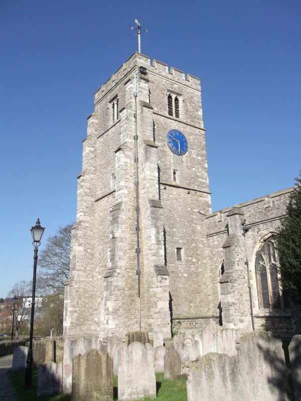
Begun in 1395 by Archbishop Courtenay as a Collegiate church and continued by Archbishop Arundel in 1396-1398, Perpendicular. Built of Kentish ragstone ashlar. Stone buttresses and crenellated parapet. South-west tower. The spire was struck by lightning in 1730 and never rebuilt. Six bay nave with clerestory and north and south aisles. Wooden roofs by Pearson 1886. The south chapel was originally the Chapel of the Fraternity of Corpus Christi. Credence and sedilia of four seats incorporating the monument of the First master of the college.
Stalls with medieval misericords. Early 17th century font. Monuments to Archbishop Courtenay d.1396, John Wotton d.1417 with a medieval wall painting at the back of the tower, Sir John Astley d.1639 and John Davy d.1631.
This is considered to be the grandest Perpendicular church in Kent.
Gateway and Wall to Palace Gardens, Wall to north-west of Archbishop's Palace, The Archbishop's Palace, Wall to east of Archbishop's Palace, The Dungeons at the Archbishop's Palace, The Gate House at the Archbishop's Palace, The Len Bridge, The Tithe Barn, Parish Church of All Saints, Wall to north and west of All Saints Church, The College Gateway, The College Tower, The Masters House, The Master's Tower, Cutbush Almshouses and the Ruined Gateway form a group
Listing NGR: TQ7599855415
External links are from the relevant listing authority and, where applicable, Wikidata. Wikidata IDs may be related buildings as well as this specific building. If you want to add or update a link, you will need to do so by editing the Wikidata entry.


Other nearby listed buildings
