Approximate Location Map
Large Map »
Latitude: 53.658 / 53°39'28"N
Longitude: -1.7909 / 1°47'27"W
OS Eastings: 413918
OS Northings: 417964
OS Grid: SE139179
Mapcode National: GBR HVY4.2F
Mapcode Global: WHCB1.GBF1
Plus Code: 9C5WM655+5M
Entry Name: 6, Wheathouse Road
Listing Date: 29 September 1978
Grade: II
Source: Historic England
Source ID: 1225620
English Heritage Legacy ID: 422056
ID on this website: 101225620
Location: Birkby, Kirklees, West Yorkshire, HD2
County: Kirklees
Electoral Ward/Division: Greenhead
Parish: Non Civil Parish
Built-Up Area: Huddersfield
Traditional County: Yorkshire
Lieutenancy Area (Ceremonial County): West Yorkshire
Church of England Parish: St John the Evangelist Huddersfield
Church of England Diocese: Leeds
Tagged with: Building
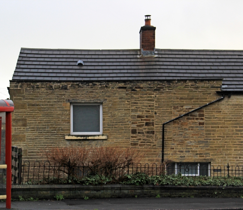
WHEATHOUSE ROAD
1.
5113
(East Side)
Birkby
No 6
SE 1317 27/1388
II
2.
Probably early C19. Hammer dressed stone. Pitched stone slate roof. 2 storeys.
One 4-light stone mullioned and transomed window on ground floor. One 4-light
stone mullioned window on 1st floor.
Listing NGR: SE1391817964
External links are from the relevant listing authority and, where applicable, Wikidata. Wikidata IDs may be related buildings as well as this specific building. If you want to add or update a link, you will need to do so by editing the Wikidata entry.


Other nearby listed buildings
