Approximate Location Map
Large Map »
Latitude: 51.4895 / 51°29'22"N
Longitude: -0.1611 / 0°9'39"W
OS Eastings: 527769
OS Northings: 178331
OS Grid: TQ277783
Mapcode National: GBR 8N.07
Mapcode Global: VHGQZ.5T6J
Plus Code: 9C3XFRQQ+QH
Entry Name: 17-43, Royal Avenue SW3
Listing Date: 6 May 1970
Grade: II
Source: Historic England
Source ID: 1226296
English Heritage Legacy ID: 423520
ID on this website: 101226296
Location: Chelsea, Kensington and Chelsea, London, SW3
County: London
District: Kensington and Chelsea
Electoral Ward/Division: Royal Hospital
Parish: Non Civil Parish
Built-Up Area: Kensington and Chelsea
Traditional County: Middlesex
Lieutenancy Area (Ceremonial County): Greater London
Church of England Parish: St Luke and Christ Church Chelsea
Church of England Diocese: London
Tagged with: Building
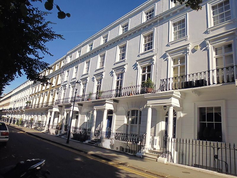
TQ 2778 SE ROYAL AVENUE SW3
57/32
6.5.70 Nos 17 to 43 (odd)
GV
II
Terrace of houses. Early-mid C19. Stucco. Four storeys and basements. Two windows
wide. Included on account of group value with remainder of Royal Avenue and its
relation to the Royal Hospital.
Listing NGR: TQ2776978331
External links are from the relevant listing authority and, where applicable, Wikidata. Wikidata IDs may be related buildings as well as this specific building. If you want to add or update a link, you will need to do so by editing the Wikidata entry.


Other nearby listed buildings
