Approximate Location Map
Large Map »
Latitude: 51.5412 / 51°32'28"N
Longitude: -0.0464 / 0°2'46"W
OS Eastings: 535578
OS Northings: 184288
OS Grid: TQ355842
Mapcode National: GBR J7.QYN
Mapcode Global: VHGQV.4JVC
Plus Code: 9C3XGXR3+FF
Entry Name: Wall to East of Number 3, Monger House
Listing Date: 4 February 1975
Grade: II
Source: Historic England
Source ID: 1226451
English Heritage Legacy ID: 423668
ID on this website: 101226451
Location: South Hackney, Hackney, London, E9
County: London
District: Hackney
Electoral Ward/Division: Hackney Wick
Parish: Non Civil Parish
Built-Up Area: Hackney
Traditional County: Middlesex
Lieutenancy Area (Ceremonial County): Greater London
Church of England Parish: St John of Jerusalem South Hackney
Church of England Diocese: London
Tagged with: Wall
1.
5013
TQ 3584
26/109
CHURCH CRESCENT E9
(North Side)
Wall to East of No 3, Monger House
II
GV
2.
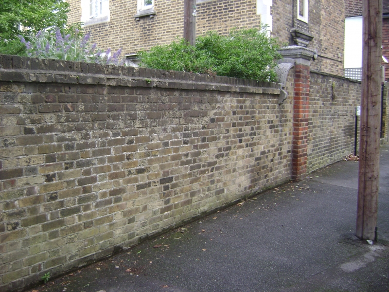
High Mid C19 stock brick wall with moulded stone coping. Square pier and ramped
section at South end.
Nos 1 to 7 (consec) and Monger House and East Wall form a group.
Listing NGR: TQ3557884288
External links are from the relevant listing authority and, where applicable, Wikidata. Wikidata IDs may be related buildings as well as this specific building. If you want to add or update a link, you will need to do so by editing the Wikidata entry.


Other nearby listed buildings
