Approximate Location Map
Large Map »
Latitude: 53.608 / 53°36'28"N
Longitude: -1.7962 / 1°47'46"W
OS Eastings: 413582
OS Northings: 412405
OS Grid: SE135124
Mapcode National: GBR HVWQ.XC
Mapcode Global: WHCB7.CKXW
Plus Code: 9C5WJ653+6G
Entry Name: Mag Bridge
Listing Date: 4 August 1983
Grade: II
Source: Historic England
Source ID: 1228218
English Heritage Legacy ID: 340430
ID on this website: 101228218
Location: Mag Dale, Kirklees, West Yorkshire, HD9
County: Kirklees
Civil Parish: Holme Valley
Built-Up Area: Holmfirth
Traditional County: Yorkshire
Lieutenancy Area (Ceremonial County): West Yorkshire
Church of England Parish: South Crosland Holy Trinity
Church of England Diocese: Leeds
Tagged with: Bridge
SE 1312 MAGDALE
9/203 (Honley)
Mag Bridge
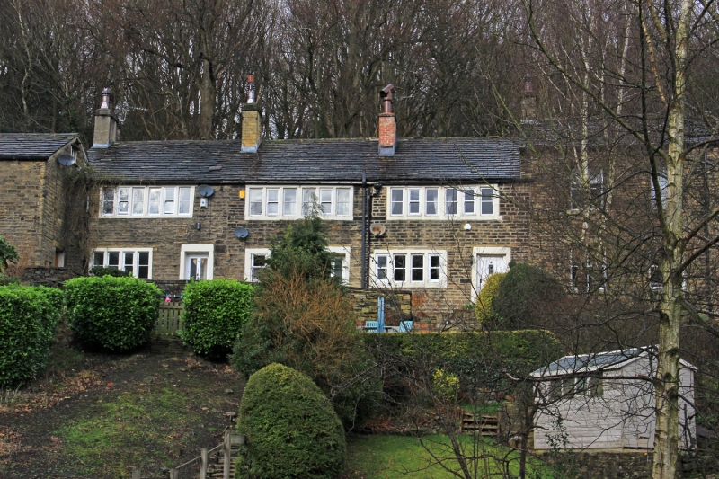
Nos 2, 3 and 4
II
Part of terrace. Late C18-early C19. Hammer dressed stone. Stone slate roof. Two
storeys. South elevation: entrance to each dwelling with 4-light stone mullioned
window to Nos 2 and 4 and 2-light to No 3. To first floor, each dwelling has one
6-light stone mullioned window.
Listing NGR: SE1358212405
External links are from the relevant listing authority and, where applicable, Wikidata. Wikidata IDs may be related buildings as well as this specific building. If you want to add or update a link, you will need to do so by editing the Wikidata entry.


Other nearby listed buildings
