Approximate Location Map
Large Map »
Latitude: 53.6462 / 53°38'46"N
Longitude: -1.7828 / 1°46'57"W
OS Eastings: 414458
OS Northings: 416658
OS Grid: SE144166
Mapcode National: GBR HVZ8.VN
Mapcode Global: WHCB1.LM82
Plus Code: 9C5WJ6W8+FV
Entry Name: 2-14, New Street
Listing Date: 29 September 1978
Grade: II
Source: Historic England
Source ID: 1228380
English Heritage Legacy ID: 402872
ID on this website: 101228380
Location: Huddersfield, Kirklees, West Yorkshire, HD1
County: Kirklees
Electoral Ward/Division: Newsome
Parish: Non Civil Parish
Built-Up Area: Huddersfield
Traditional County: Yorkshire
Lieutenancy Area (Ceremonial County): West Yorkshire
Church of England Parish: Huddersfield St Peter
Church of England Diocese: Leeds
Tagged with: Building
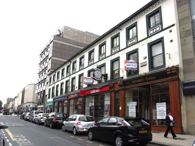
NEW STREET
1.
5113
(West Side)
Nos 2 to 14 (even)
SE 1416 NW 1/941
II
2.
C18 or early C19, refaced in mid C19. Stucco. Pitched stone slate roof.
3 storeys. Modillion eaves cornice. Moulded string below 2nd floor windows.
Modern shops. 12 ranges of sashes in moulded surrounds, those on 2nd floor
with moulded panels in aprons.
Listing NGR: SE1444416677
External links are from the relevant listing authority and, where applicable, Wikidata. Wikidata IDs may be related buildings as well as this specific building. If you want to add or update a link, you will need to do so by editing the Wikidata entry.


Other nearby listed buildings
