Approximate Location Map
Large Map »
Latitude: 53.6559 / 53°39'21"N
Longitude: -1.8382 / 1°50'17"W
OS Eastings: 410787
OS Northings: 417729
OS Grid: SE107177
Mapcode National: GBR HVL5.T5
Mapcode Global: WHCB0.QCVM
Plus Code: 9C5WM546+9P
Entry Name: 390, New Hey Road
Listing Date: 29 September 1978
Grade: II
Source: Historic England
Source ID: 1228445
English Heritage Legacy ID: 403058
ID on this website: 101228445
Location: Salendine Nook, Kirklees, West Yorkshire, HD3
County: Kirklees
Electoral Ward/Division: Lindley
Parish: Non Civil Parish
Built-Up Area: Huddersfield
Traditional County: Yorkshire
Lieutenancy Area (Ceremonial County): West Yorkshire
Church of England Parish: Lindley St Stephen
Church of England Diocese: Leeds
Tagged with: Building
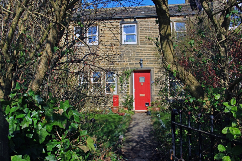
NEW HEY ROAD
1.
5113
(North Side)
No 390
SE 1017 26/960
II GV
2.
Early C19. Hammer-dressed stone. Pitched stone slate roof. Coped gable.
2 storeys. Stone brackets to gutter. Two 2-light stone mullioned sashes and
one single-light sash on 1st floor. One 3-light stone mullioned window and
one casement on ground floor.
Listing NGR: SE1078717729
External links are from the relevant listing authority and, where applicable, Wikidata. Wikidata IDs may be related buildings as well as this specific building. If you want to add or update a link, you will need to do so by editing the Wikidata entry.


Other nearby listed buildings
