Approximate Location Map
Large Map »
Latitude: 50.7119 / 50°42'42"N
Longitude: -2.7614 / 2°45'41"W
OS Eastings: 346334
OS Northings: 90527
OS Grid: SY463905
Mapcode National: GBR PP.1Q52
Mapcode Global: FRA 5736.80P
Plus Code: 9C2VP66Q+QC
Entry Name: The George Hotel
Listing Date: 19 September 1975
Grade: II
Source: Historic England
Source ID: 1228730
English Heritage Legacy ID: 403406
ID on this website: 101228730
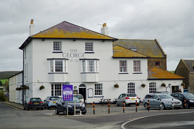
1.
5191 WEST BAY
WEST OF WEST BAY ROAD
AND NORTH OF THE HARBOUR
The George Hotel
SY 4690 10/189
II
2.
Early or mid C19. Stucco. Hipped slate roof. 3 storeys. 3 ranges of sashes
with glazing bars. 2 canted bays to 1st floor. 1 round headed doorway.
Listing NGR: SY4633490527
External links are from the relevant listing authority and, where applicable, Wikidata. Wikidata IDs may be related buildings as well as this specific building. If you want to add or update a link, you will need to do so by editing the Wikidata entry.


Other nearby listed buildings
