Approximate Location Map
Large Map »
Latitude: 53.7136 / 53°42'48"N
Longitude: -2.0947 / 2°5'41"W
OS Eastings: 393844
OS Northings: 424132
OS Grid: SD938241
Mapcode National: GBR FTTH.9J
Mapcode Global: WHB8C.SXPH
Plus Code: 9C5VPW74+C4
Entry Name: North View
Listing Date: 22 February 1984
Grade: II
Source: Historic England
Source ID: 1228982
English Heritage Legacy ID: 403715
ID on this website: 101228982
Location: Todmorden, Calderdale, West Yorkshire, OL14
County: Calderdale
Civil Parish: Todmorden
Built-Up Area: Todmorden
Traditional County: Yorkshire
Lieutenancy Area (Ceremonial County): West Yorkshire
Church of England Parish: Todmorden St Mary
Church of England Diocese: Leeds
Tagged with: Building
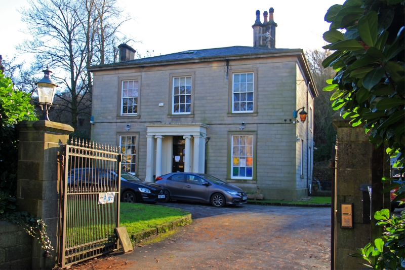
SD 9324 TODMORDEN (former M.B.) HALIFAX ROAD
(south side)
6/134 North View
G.V. II
House. c.1840. Ashlar, slate roof. 2 storeys. 3-bay symmetrical facade.
Plinth, quoins, cornice. Porch with Ionic columns distyle in antis. Large
windows with architrave sashed throughout. 2 stacks. Is one of a pair next to
each other, see Todmorden Working Men's Social Club, (q.v.)
Listing NGR: SD9384424132
External links are from the relevant listing authority and, where applicable, Wikidata. Wikidata IDs may be related buildings as well as this specific building. If you want to add or update a link, you will need to do so by editing the Wikidata entry.


Other nearby listed buildings
