Approximate Location Map
Large Map »
Latitude: 53.7137 / 53°42'49"N
Longitude: -2.0865 / 2°5'11"W
OS Eastings: 394387
OS Northings: 424151
OS Grid: SD943241
Mapcode National: GBR FTWH.2G
Mapcode Global: WHB8C.XXLB
Plus Code: 9C5VPW77+F9
Entry Name: Kilnhurst Bridge
Listing Date: 22 February 1984
Grade: II
Source: Historic England
Source ID: 1228995
English Heritage Legacy ID: 403746
ID on this website: 101228995
Location: Kilnhurst, Calderdale, West Yorkshire, OL14
County: Calderdale
Civil Parish: Todmorden
Built-Up Area: Todmorden
Traditional County: Yorkshire
Lieutenancy Area (Ceremonial County): West Yorkshire
Church of England Parish: Todmorden St Mary
Church of England Diocese: Leeds
Tagged with: Bridge
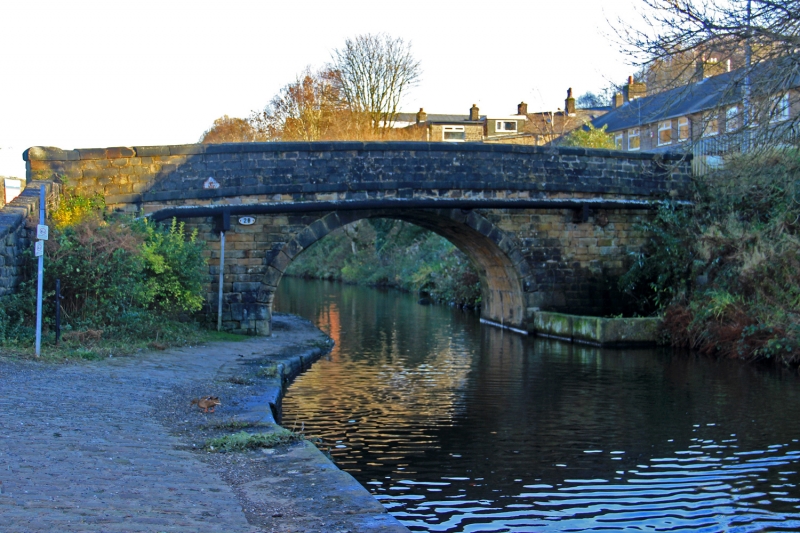
SD 92SW TODMORDEN (former M.B.) KILNHURST ROAD
5/166 Kilnhurst Bridge
II
Bridge over Rochdale Canal. Late C18. Hammer-dressed stone. Single span
horse-shoe elliptical arch. Band, parapet with cappings and square buttressed
ends.
Listing NGR: SD9438724151
External links are from the relevant listing authority and, where applicable, Wikidata. Wikidata IDs may be related buildings as well as this specific building. If you want to add or update a link, you will need to do so by editing the Wikidata entry.


Other nearby listed buildings
