Approximate Location Map
Large Map »
Latitude: 50.7338 / 50°44'1"N
Longitude: -2.7585 / 2°45'30"W
OS Eastings: 346568
OS Northings: 92964
OS Grid: SY465929
Mapcode National: GBR PP.0BYY
Mapcode Global: FRA 5734.P4F
Plus Code: 9C2VP6MR+GJ
Entry Name: 7, West Street
Listing Date: 19 September 1975
Grade: II
Source: Historic England
Source ID: 1229167
English Heritage Legacy ID: 403945
ID on this website: 101229167
Location: Bridport, Dorset, DT6
County: Dorset
Civil Parish: Bridport
Built-Up Area: Bridport
Traditional County: Dorset
Lieutenancy Area (Ceremonial County): Dorset
Church of England Parish: Bridport St Mary
Church of England Diocese: Salisbury
Tagged with: Building
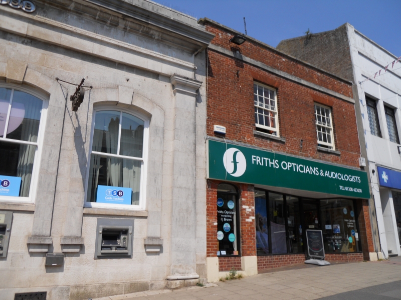
1.
5191 WEST STREET
(North Side)
No 7
SY 4692 1/175
II GV
2.
C18. Red brick. 2 storeys. Stringcourse. Parapet. 2 ranges sashes with glazing
bars. 1 attic dormer. Ground floor has later shopfront, and doorway with elliptical
head, fanlight and door with moulded panels.
Nos 7 to 25 (odd) form a group.
Listing NGR: SY4656992969
External links are from the relevant listing authority and, where applicable, Wikidata. Wikidata IDs may be related buildings as well as this specific building. If you want to add or update a link, you will need to do so by editing the Wikidata entry.


Other nearby listed buildings
