Approximate Location Map
Large Map »
Latitude: 53.5654 / 53°33'55"N
Longitude: -1.8025 / 1°48'8"W
OS Eastings: 413178
OS Northings: 407661
OS Grid: SE131076
Mapcode National: GBR HWV6.KM
Mapcode Global: WHCBF.8NX1
Plus Code: 9C5WH58X+52
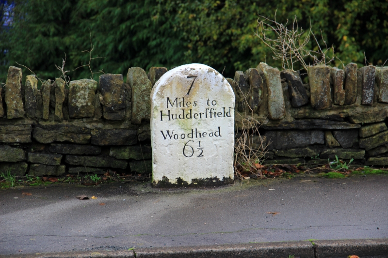
Entry Name: 7 Miles Post Opposite Spring Lane Mills
Listing Date: 4 August 1983
Grade: II
Source: Historic England
Source ID: 1229557
English Heritage Legacy ID: 340631
ID on this website: 101229557
Location: Burnlee, Kirklees, West Yorkshire, HD9
County: Kirklees
Civil Parish: Holme Valley
Built-Up Area: Holmfirth
Traditional County: Yorkshire
Lieutenancy Area (Ceremonial County): West Yorkshire
Church of England Parish: Holmbridge St David
Church of England Diocese: Leeds
SE 10 NW WOODHEAD ROAD
4/403 (Burnlee)
7 Miles Post Opposite
Spring Lane Mills
II
Mile post. Early to mid C19. Painted stone post with rounded top with inscription:
7
Miles to
Huddersfield
Woodhead
6½
Listing NGR: SE1317807661
External links are from the relevant listing authority and, where applicable, Wikidata. Wikidata IDs may be related buildings as well as this specific building. If you want to add or update a link, you will need to do so by editing the Wikidata entry.


Other nearby listed buildings
