Approximate Location Map
Large Map »
Latitude: 53.5938 / 53°35'37"N
Longitude: -1.93 / 1°55'47"W
OS Eastings: 404730
OS Northings: 410810
OS Grid: SE047108
Mapcode National: GBR GVYW.YF
Mapcode Global: WHB91.BX6R
Plus Code: 9C5WH3VC+G2
Entry Name: Bridge
Listing Date: 11 July 1985
Grade: II
Source: Historic England
Source ID: 1230993
English Heritage Legacy ID: 405960
ID on this website: 101230993
Location: Marsden, Kirklees, West Yorkshire, HD7
County: Kirklees
Electoral Ward/Division: Colne Valley
Parish: Non Civil Parish
Built-Up Area: Marsden
Traditional County: Yorkshire
Lieutenancy Area (Ceremonial County): West Yorkshire
Church of England Parish: Marsden St Bartholomew
Church of England Diocese: Leeds
Tagged with: Bridge
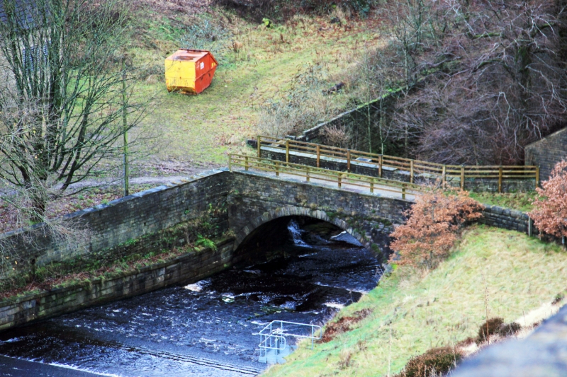
SE Ol SW BANK BOTTOM BRIDGE
Marsden
4/14
Bridge
-
- II
Early to mid C19. Bridge. Single span segmental arched bridge over overflow from
Butterly Reservoir. Hammer dressed stone with slightly rusticated dressings. Pronounced
string course forms base to parapet which has flagstone copings. More recent arched
culverts to either side of bridge.
Listing NGR: SE0473010810
External links are from the relevant listing authority and, where applicable, Wikidata. Wikidata IDs may be related buildings as well as this specific building. If you want to add or update a link, you will need to do so by editing the Wikidata entry.


Other nearby listed buildings
