Approximate Location Map
Large Map »
Latitude: 53.6474 / 53°38'50"N
Longitude: -1.7758 / 1°46'32"W
OS Eastings: 414917
OS Northings: 416794
OS Grid: SE149167
Mapcode National: GBR JV18.B7
Mapcode Global: WHCB1.PLL5
Plus Code: 9C5WJ6WF+XM
Entry Name: John L Brierleys Mill
Listing Date: 29 September 1978
Grade: II
Source: Historic England
Source ID: 1231214
English Heritage Legacy ID: 406290
ID on this website: 101231214
Location: Aspley, Kirklees, West Yorkshire, HD1
County: Kirklees
Electoral Ward/Division: Dalton
Parish: Non Civil Parish
Built-Up Area: Huddersfield
Traditional County: Yorkshire
Lieutenancy Area (Ceremonial County): West Yorkshire
Church of England Parish: Huddersfield St Peter
Church of England Diocese: Leeds
Tagged with: Mill building
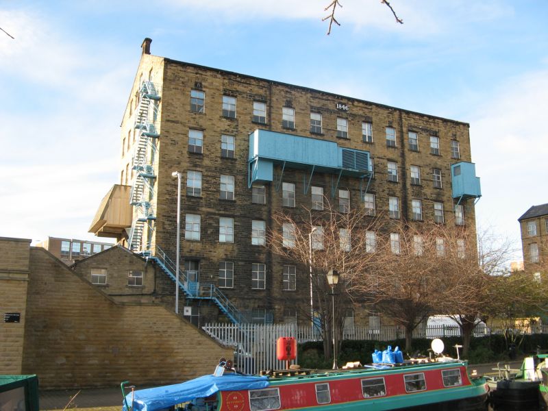
QUAY STREET
1.
5113
(South Side)
SE 1416 NE 2/1106 John L Brierley's Mill
II
2.
1846 (dated). Hammer dressed stone. Pitched slate roof. Coped gable ends.
7 storeys. 11 window ranges, 6 in end elevations. Venetian window in top
floor of end elevations.
Listing NGR: SE1491716794
External links are from the relevant listing authority and, where applicable, Wikidata. Wikidata IDs may be related buildings as well as this specific building. If you want to add or update a link, you will need to do so by editing the Wikidata entry.


Other nearby listed buildings
