Approximate Location Map
Large Map »
Latitude: 52.9555 / 52°57'19"N
Longitude: 0.8521 / 0°51'7"E
OS Eastings: 591679
OS Northings: 343601
OS Grid: TF916436
Mapcode National: GBR R5T.L8C
Mapcode Global: WHLQK.2Z03
Plus Code: 9F42XV42+6R
Entry Name: 41, Staithe Street
Listing Date: 13 June 1972
Grade: II
Source: Historic England
Source ID: 1231695
English Heritage Legacy ID: 406833
ID on this website: 101231695
Location: Wells-next-the-Sea, North Norfolk, NR23
County: Norfolk
District: North Norfolk
Civil Parish: Wells-next-the-Sea
Built-Up Area: Wells-next-the-Sea
Traditional County: Norfolk
Lieutenancy Area (Ceremonial County): Norfolk
Church of England Parish: Wells-next-the-Sea St Nicholas
Church of England Diocese: Norwich
Tagged with: Building
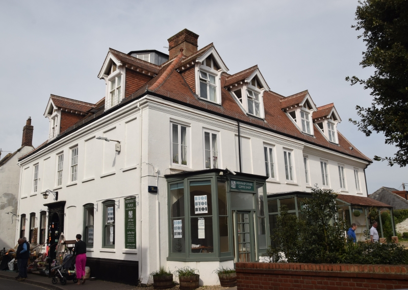
1793 STAITHE STREET
(West Side)
No.41
TF 9143 615/2/123
GV II
Early C18 altered, 2 storey and attic, brick plastered and painted, toothed eaves band. Pantile-roof, gabled casement dormer. Shop window ground floor.
Nos 27 to 73 (odd) form a group.
Listing NGR: TF9167943601
External links are from the relevant listing authority and, where applicable, Wikidata. Wikidata IDs may be related buildings as well as this specific building. If you want to add or update a link, you will need to do so by editing the Wikidata entry.


Other nearby listed buildings
