Approximate Location Map
Large Map »
Latitude: 55.5985 / 55°35'54"N
Longitude: -1.8287 / 1°49'43"W
OS Eastings: 410892
OS Northings: 633890
OS Grid: NU108338
Mapcode National: GBR H3NP.WX
Mapcode Global: WHC0J.WJCY
Plus Code: 9C7WH5XC+CG
Entry Name: 9, High Street
Listing Date: 26 August 1987
Grade: II
Source: Historic England
Source ID: 1233322
English Heritage Legacy ID: 408812
ID on this website: 101233322
Location: Belford, Northumberland, NE70
County: Northumberland
Civil Parish: Belford
Built-Up Area: Belford
Traditional County: Northumberland
Lieutenancy Area (Ceremonial County): Northumberland
Church of England Parish: Belford St Mary
Church of England Diocese: Newcastle
Tagged with: Building
BELFORD HIGH STREET
NU 1033
(East side)
19/97 No. 9
GV II
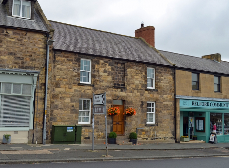
House. Late C18 or early C19. Dressed stone with plinth; Welsh slate roof.
2 storeys, 3 bays. 3 steps up to central panelled door with overlight. Blank
window over door. Elsewhere 12-pane sashes with projecting sills. Gabled
roof with flat coping, kneeler and rendered end stack.
Listing NGR: NU1089133895
External links are from the relevant listing authority and, where applicable, Wikidata. Wikidata IDs may be related buildings as well as this specific building. If you want to add or update a link, you will need to do so by editing the Wikidata entry.


Other nearby listed buildings
