Approximate Location Map
Large Map »
Latitude: 51.5709 / 51°34'15"N
Longitude: -0.7783 / 0°46'41"W
OS Eastings: 484765
OS Northings: 186484
OS Grid: SU847864
Mapcode National: GBR D5W.G1J
Mapcode Global: VHDWB.GSD4
Plus Code: 9C3XH6CC+8M
Entry Name: 39, West Street
Listing Date: 31 January 1974
Grade: II
Source: Historic England
Source ID: 1235105
English Heritage Legacy ID: 411260
ID on this website: 101235105
Location: Marlow, Buckinghamshire, SL7
County: Buckinghamshire
Civil Parish: Marlow
Built-Up Area: Marlow
Traditional County: Buckinghamshire
Lieutenancy Area (Ceremonial County): Buckinghamshire
Church of England Parish: Great Marlow with Marlow Bottom, Little Marlow and Bisham
Church of England Diocese: Oxford
Tagged with: Building
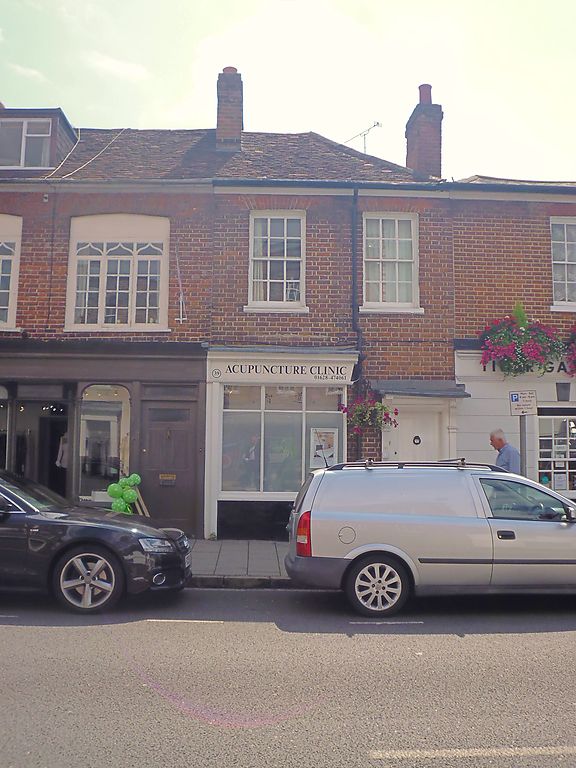
WEST STREET
1.
l385
(South East Side)
No 39
SU 8486 1/69A
II GV
2.
Mid Cl8. 2 storeys. 2 windows. Red brick. Glazing bars intact. Half
hipped tile roof to right. Moulded cornice. Shop front. Door with
reeded architrave, console brackets and small hood on right hand side.
Nos 27 to 33 (odd) and Nos 37 to 51 (odd) form a group.
Listing NGR: SU8476586484
External links are from the relevant listing authority and, where applicable, Wikidata. Wikidata IDs may be related buildings as well as this specific building. If you want to add or update a link, you will need to do so by editing the Wikidata entry.


Other nearby listed buildings
