Approximate Location Map
Large Map »
Latitude: 51.5672 / 51°34'2"N
Longitude: -0.0606 / 0°3'38"W
OS Eastings: 534512
OS Northings: 187154
OS Grid: TQ345871
Mapcode National: GBR J5.TN7
Mapcode Global: VHGQM.WVTY
Plus Code: 9C3XHW8Q+VP
Entry Name: Post Office Pillar Box Outside Number 210
Listing Date: 4 February 1975
Grade: II
Source: Historic England
Source ID: 1235549
English Heritage Legacy ID: 426296
ID on this website: 101235549
Location: Springfield, Hackney, London, E5
County: Hackney
Electoral Ward/Division: Cazenove
Built-Up Area: Hackney
Traditional County: Middlesex
Lieutenancy Area (Ceremonial County): Greater London
Church of England Parish: St Matthew Upper Clapton
Church of England Diocese: London
Tagged with: Pillar box
1. UPPER CLAPTON ROAD E5
5013
(East Side)
---------------------
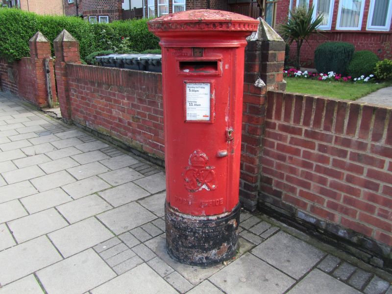
Post Office Pillar Box
outside No 210
TQ 3487 8/656
II
2.
1866-76 to the design of J W Penfold. Hexagonal pillar box with high, roll-moulded
plinth, ball cornice and raised ogee top with leaf pattern and pine-cone finial.
Finial missing.
Listing NGR: TQ3451287154
External links are from the relevant listing authority and, where applicable, Wikidata. Wikidata IDs may be related buildings as well as this specific building. If you want to add or update a link, you will need to do so by editing the Wikidata entry.


Other nearby listed buildings
