Approximate Location Map
Large Map »
Latitude: 51.5107 / 51°30'38"N
Longitude: -0.1194 / 0°7'10"W
OS Eastings: 530598
OS Northings: 180759
OS Grid: TQ305807
Mapcode National: GBR KD.BM
Mapcode Global: VHGQZ.W968
Plus Code: 9C3XGV6J+76
Entry Name: Churchyard Railings and Gates
Listing Date: 1 December 1987
Grade: II
Source: Historic England
Source ID: 1236138
English Heritage Legacy ID: 427057
ID on this website: 101236138
Location: Strand, Westminster, London, WC2R
County: London
District: City of Westminster
Electoral Ward/Division: St James's
Parish: Non Civil Parish
Built-Up Area: City of Westminster
Traditional County: Middlesex
Lieutenancy Area (Ceremonial County): Greater London
Tagged with: Railing
TQ 3080 NE CITY OF WESTMINSTER SAVOY HILL, WC2
73/42
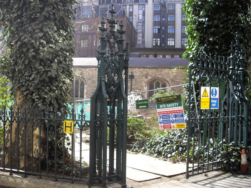
Churchyard Railings and
Gates
G.V. II
Railings and gates. c1864,part of Sidney Smirke's restoration programme. Cast
iron railings, gates and gate piers on dwarf stone rubble wall. Gothic pattern
with Queen Victoria's cypher worked into the tracery panelling of the openwork
gate piers.
Listing NGR: TQ3059880759
External links are from the relevant listing authority and, where applicable, Wikidata. Wikidata IDs may be related buildings as well as this specific building. If you want to add or update a link, you will need to do so by editing the Wikidata entry.


Other nearby listed buildings
