Approximate Location Map
Large Map »
Latitude: 52.8281 / 52°49'41"N
Longitude: -0.9908 / 0°59'26"W
OS Eastings: 468097
OS Northings: 326092
OS Grid: SK680260
Mapcode National: GBR 9LN.NBH
Mapcode Global: WHFJR.R5DS
Plus Code: 9C4XR2H5+6M
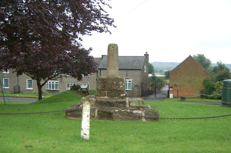
Entry Name: The Village Cross
Listing Date: 25 September 1979
Grade: II
Source: Historic England
Source ID: 1236625
English Heritage Legacy ID: 427666
ID on this website: 101236625
Location: Upper Broughton, Rushcliffe, Nottinghamshire, LE14
County: Nottinghamshire
District: Rushcliffe
Civil Parish: Upper Broughton
Built-Up Area: Upper Broughton
Traditional County: Nottinghamshire
Lieutenancy Area (Ceremonial County): Nottinghamshire
Church of England Parish: Broughton Sulney
Church of England Diocese: Southwell and Nottingham
Tagged with: High cross
UPPER BROUGHTON TOP GREEN
SK62NE (south side)
6/153 The Village Cross
25.9.79
- II
Village cross. Medieval. Limestone. Square short shaft on a
deep base. Well worn 2-step podium. Good village centre site.
Listing NGR: SK6809726092
External links are from the relevant listing authority and, where applicable, Wikidata. Wikidata IDs may be related buildings as well as this specific building. If you want to add or update a link, you will need to do so by editing the Wikidata entry.


Other nearby listed buildings
