Approximate Location Map
Large Map »
Latitude: 50.429 / 50°25'44"N
Longitude: -3.6841 / 3°41'2"W
OS Eastings: 280478
OS Northings: 60149
OS Grid: SX804601
Mapcode National: GBR QM.TF6T
Mapcode Global: FRA 375X.GK4
Plus Code: 9C2RC8H8+J9
Entry Name: 13, Warland
Listing Date: 16 March 1978
Grade: II
Source: Historic England
Source ID: 1236979
English Heritage Legacy ID: 428104
ID on this website: 101236979
Location: Totnes, South Hams, Devon, TQ9
County: Devon
District: South Hams
Civil Parish: Totnes
Built-Up Area: Totnes
Traditional County: Devon
Lieutenancy Area (Ceremonial County): Devon
Church of England Parish: Totnes St Mary
Church of England Diocese: Exeter
Tagged with: Building
1.
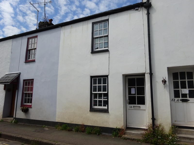
5180 WARLAND
(West Side)
No 13
SX 8060 4/234
II GV
2.
Earlier C19 cottage. 2 storeys. Double fronted with 2 windows. Welsh slate roof.
Rendered front. Flush framed sash windows with glazing bars. Recessed doorway
with panelled door.
Listing NGR: SX8047860148
External links are from the relevant listing authority and, where applicable, Wikidata. Wikidata IDs may be related buildings as well as this specific building. If you want to add or update a link, you will need to do so by editing the Wikidata entry.


Other nearby listed buildings
