Approximate Location Map
Large Map »
Latitude: 51.7453 / 51°44'43"N
Longitude: -2.2164 / 2°12'59"W
OS Eastings: 385155
OS Northings: 205199
OS Grid: SO851051
Mapcode National: GBR 1MK.JFZ
Mapcode Global: VH94Y.JDMD
Plus Code: 9C3VPQWM+4C
Entry Name: 15, High Street
Listing Date: 25 June 1974
Grade: II
Source: Historic England
Source ID: 1238226
English Heritage Legacy ID: 415670
ID on this website: 101238226
Location: Stroud, Gloucestershire, GL5
County: Gloucestershire
District: Stroud
Civil Parish: Stroud
Built-Up Area: Stroud
Traditional County: Gloucestershire
Lieutenancy Area (Ceremonial County): Gloucestershire
Church of England Parish: Stroud St Laurence
Church of England Diocese: Gloucester
Tagged with: Building
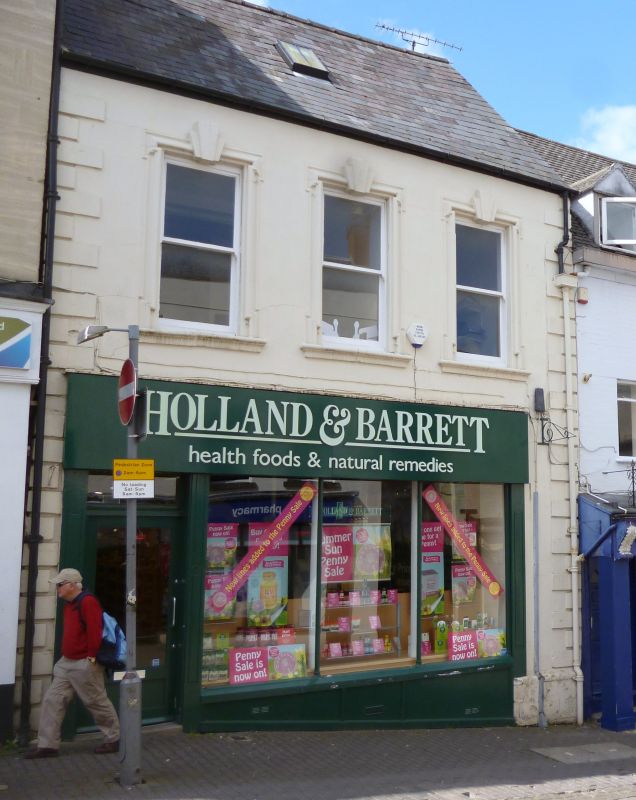
1. HIGH STREET
5227
(South Side)
No 15
SO 8505 5/304
II
2.
Early/mid C18. Rendered front. 2 storeys. Rusticated quoins. 3 C19 double-hung
sash windows in original moulded embrasures (architraves shouldered at top and
bottom, triple keystones, and bull-nosed sills). Modern ground floor. Staircase
inside with fluted balusters, and rails ramped to the newel.
Listing NGR: SO8515505199
External links are from the relevant listing authority and, where applicable, Wikidata. Wikidata IDs may be related buildings as well as this specific building. If you want to add or update a link, you will need to do so by editing the Wikidata entry.


Other nearby listed buildings
