Approximate Location Map
Large Map »
Latitude: 51.3875 / 51°23'14"N
Longitude: 0.2381 / 0°14'17"E
OS Eastings: 555828
OS Northings: 167756
OS Grid: TQ558677
Mapcode National: GBR VM.BPS
Mapcode Global: VHHP7.2DR7
Plus Code: 9F3296PQ+X6
Entry Name: Little Franks
Listing Date: 22 October 1982
Grade: II
Source: Historic England
Source ID: 1238943
English Heritage Legacy ID: 416418
ID on this website: 101238943
Location: Horton Kirby, Sevenoaks, Kent, DA4
County: Kent
District: Sevenoaks
Civil Parish: Horton Kirby and South Darenth
Traditional County: Kent
Lieutenancy Area (Ceremonial County): Kent
Church of England Parish: Horton Kirby St Mary
Church of England Diocese: Rochester
Tagged with: Architectural structure
HORTON KIRBY FRANKS LANE
1.
5280
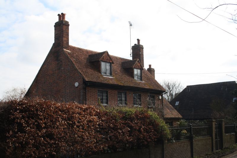
Little Franks
TQ 56 NE 3/181
II
2.
C17 much restored. Two storeys red brick. Tiled roof with 2 gabled dormers.
Four casement windows. Later gabled weather porch. Crown fireplaque. Interior
has exposed beams.
Listing NGR: TQ5582867756
External links are from the relevant listing authority and, where applicable, Wikidata. Wikidata IDs may be related buildings as well as this specific building. If you want to add or update a link, you will need to do so by editing the Wikidata entry.


Other nearby listed buildings
