Approximate Location Map
Large Map »
Latitude: 51.7459 / 51°44'45"N
Longitude: -2.2179 / 2°13'4"W
OS Eastings: 385054
OS Northings: 205262
OS Grid: SO850052
Mapcode National: GBR 1MK.J2T
Mapcode Global: VH94Y.HCVZ
Plus Code: 9C3VPQWJ+8V
Entry Name: 23 and 25, King Street
Listing Date: 25 June 1974
Grade: II
Source: Historic England
Source ID: 1239607
English Heritage Legacy ID: 417555
ID on this website: 101239607
Location: Stroud, Gloucestershire, GL5
County: Gloucestershire
District: Stroud
Civil Parish: Stroud
Built-Up Area: Stroud
Traditional County: Gloucestershire
Lieutenancy Area (Ceremonial County): Gloucestershire
Church of England Parish: Stroud St Laurence
Church of England Diocese: Gloucester
Tagged with: Building
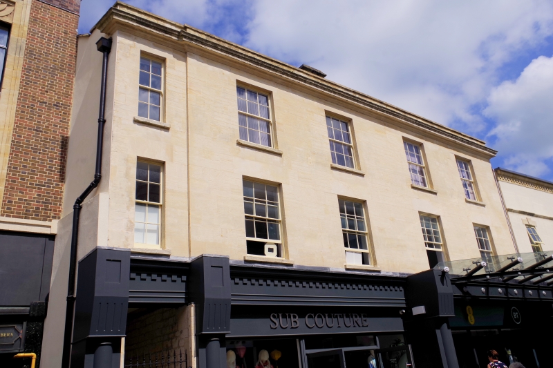
1. KING STREET
5227
(West Side)
Nos 23 & 25
SO 8525 5/326
II
2.
C18. Ashlar. 3 storeys. Moulded eaves cornice and blocking course. 5 ranges
of double-hung sash windows with glazing bars. Mid C19 shopfronts with Tuscan
pilasters.
Listing NGR: SO8505405262
External links are from the relevant listing authority and, where applicable, Wikidata. Wikidata IDs may be related buildings as well as this specific building. If you want to add or update a link, you will need to do so by editing the Wikidata entry.


Other nearby listed buildings
