Approximate Location Map
Large Map »
Latitude: 51.3174 / 51°19'2"N
Longitude: 0.8928 / 0°53'34"E
OS Eastings: 601682
OS Northings: 161562
OS Grid: TR016615
Mapcode National: GBR SW3.BK9
Mapcode Global: VHKJW.F4CX
Plus Code: 9F328V8V+X4
Entry Name: Wall and Gate Pier Between Laboratory and Brewery House
Listing Date: 9 July 1990
Grade: II
Source: Historic England
Source ID: 1240514
English Heritage Legacy ID: 438962
ID on this website: 101240514
Location: Faversham, Swale, Kent, ME13
County: Kent
District: Swale
Civil Parish: Faversham
Built-Up Area: Faversham
Traditional County: Kent
Lieutenancy Area (Ceremonial County): Kent
Tagged with: Wall
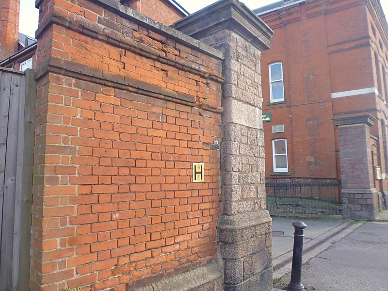
FAVERSHAM COURT STREET
TQ 0161 NE
1/394 Wall and Gate Pier
between Laboratory and
Brewery House
GV II
Wall and gate pier. c.1880. Comprises red brick wall in Flemish bond
incorporating 2 granite gate piers, plinth and cambered entrance.
Listing NGR: TR0168361563
External links are from the relevant listing authority and, where applicable, Wikidata. Wikidata IDs may be related buildings as well as this specific building. If you want to add or update a link, you will need to do so by editing the Wikidata entry.


Other nearby listed buildings
