Approximate Location Map
Large Map »
Latitude: 51.2829 / 51°16'58"N
Longitude: 1.0821 / 1°4'55"E
OS Eastings: 615031
OS Northings: 158267
OS Grid: TR150582
Mapcode National: GBR TY2.JDQ
Mapcode Global: VHLGM.P0XT
Plus Code: 9F3373MJ+5R
Entry Name: Orchard House
Listing Date: 7 September 1973
Grade: II
Source: Historic England
Source ID: 1240573
English Heritage Legacy ID: 170604
Also known as: 1 Duck Lane
ID on this website: 101240573
Location: Northgate, Canterbury, Kent, CT1
County: Kent
District: Canterbury
Electoral Ward/Division: Northgate
Parish: Non Civil Parish
Built-Up Area: Canterbury
Traditional County: Kent
Lieutenancy Area (Ceremonial County): Kent
Tagged with: House
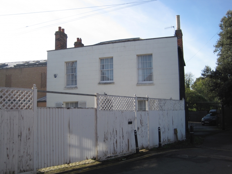
1.
944 DUCK LANE
(South West Side)
No 1 (Orchard House)
TR 1558 SW 3/488
II GV
2.
Early C19. 2 storeys stuccoed. Slate roof. Parapet with stone coping.
3 sashes with glazing bars intact and stone heads and cills. Central round-headed
doorcase with keystone, fanlight and 6 panelled door.
Nos 1 to 6 (consec) form a group.
Listing NGR: TR1502658260
External links are from the relevant listing authority and, where applicable, Wikidata. Wikidata IDs may be related buildings as well as this specific building. If you want to add or update a link, you will need to do so by editing the Wikidata entry.


Other nearby listed buildings
