Approximate Location Map
Large Map »
Latitude: 51.2845 / 51°17'4"N
Longitude: 1.0707 / 1°4'14"E
OS Eastings: 614228
OS Northings: 158402
OS Grid: TR142584
Mapcode National: GBR TY2.FHG
Mapcode Global: VHLGF.HZW7
Plus Code: 9F3373MC+Q7
Entry Name: 2, Forty Acres Road
Listing Date: 7 September 1973
Grade: II
Source: Historic England
Source ID: 1240580
English Heritage Legacy ID: 170609
ID on this website: 101240580
Location: St Dunstan's, Canterbury, Kent, CT2
County: Kent
District: Canterbury
Electoral Ward/Division: St Stephen's
Parish: Non Civil Parish
Built-Up Area: Canterbury
Traditional County: Kent
Lieutenancy Area (Ceremonial County): Kent
Tagged with: Building
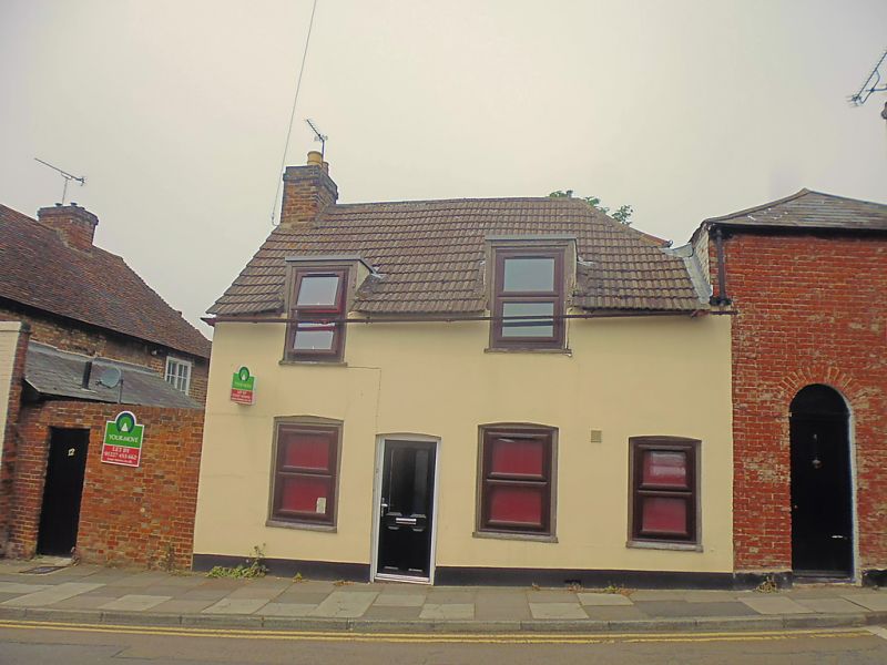
1.
944 FORTY ACRES ROAD
(South West Side)
No 2
TR 1458 SW 1/493
II GV
2.
Early C19. 2 storeys pebble dash. Old tiled roof with 2 sashes protruding
on to roof. 3 cambered sashes on ground floor, 2 with glazing bars intact.
Restored doorcase. Plinth.
Nos 2, 4 & 5 form a group.
Listing NGR: TR1422558403
External links are from the relevant listing authority and, where applicable, Wikidata. Wikidata IDs may be related buildings as well as this specific building. If you want to add or update a link, you will need to do so by editing the Wikidata entry.


Other nearby listed buildings
