Approximate Location Map
Large Map »
Latitude: 51.2787 / 51°16'43"N
Longitude: 1.0802 / 1°4'48"E
OS Eastings: 614919
OS Northings: 157795
OS Grid: TR149577
Mapcode National: GBR TY2.PXG
Mapcode Global: VHLGM.N4X1
Plus Code: 9F3373HJ+F3
Entry Name: 48, High Street
Listing Date: 7 September 1973
Grade: II
Source: Historic England
Source ID: 1240820
English Heritage Legacy ID: 439373
ID on this website: 101240820
Location: Canterbury, Kent, CT1
County: Kent
District: Canterbury
Electoral Ward/Division: Westgate
Parish: Non Civil Parish
Built-Up Area: Canterbury
Traditional County: Kent
Lieutenancy Area (Ceremonial County): Kent
Tagged with: Building
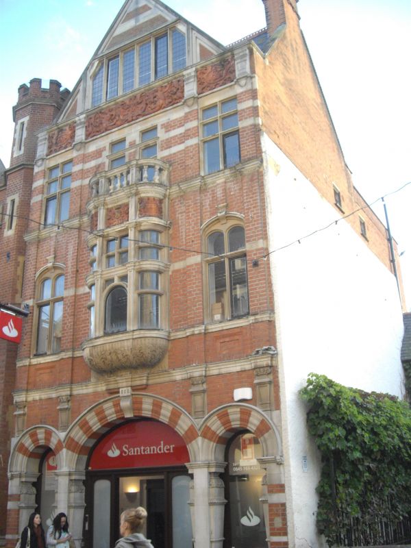
1.
944 HIGH STREET
(South West Side)
No 48
TR 1457 NE 4/514
II GV
2.
Dated 1887. 3 storeys and gable. Red brick with stone dressings. Gable
has a finial in the form of a gryphon. Windows are mullioned and transomed.
Central 1st floor oriel with putto. Grand floor has 3 round-arched windows
flanked by bulbous pilasters.
Nos 37 to 46 (consec), Nos 48 & 49 form a group.
Listing NGR: TR1491257792
External links are from the relevant listing authority and, where applicable, Wikidata. Wikidata IDs may be related buildings as well as this specific building. If you want to add or update a link, you will need to do so by editing the Wikidata entry.


Other nearby listed buildings
