Approximate Location Map
Large Map »
Latitude: 51.277 / 51°16'37"N
Longitude: 1.0858 / 1°5'8"E
OS Eastings: 615316
OS Northings: 157613
OS Grid: TR153576
Mapcode National: GBR TY2.Z71
Mapcode Global: VHLGM.R5WF
Plus Code: 9F3373GP+Q8
Entry Name: 59A, Ivy Lane
Listing Date: 7 September 1973
Grade: II
Source: Historic England
Source ID: 1240859
English Heritage Legacy ID: 439385
ID on this website: 101240859
Location: Canterbury, Kent, CT1
County: Kent
District: Canterbury
Electoral Ward/Division: Barton
Parish: Non Civil Parish
Built-Up Area: Canterbury
Traditional County: Kent
Lieutenancy Area (Ceremonial County): Kent
Tagged with: Building
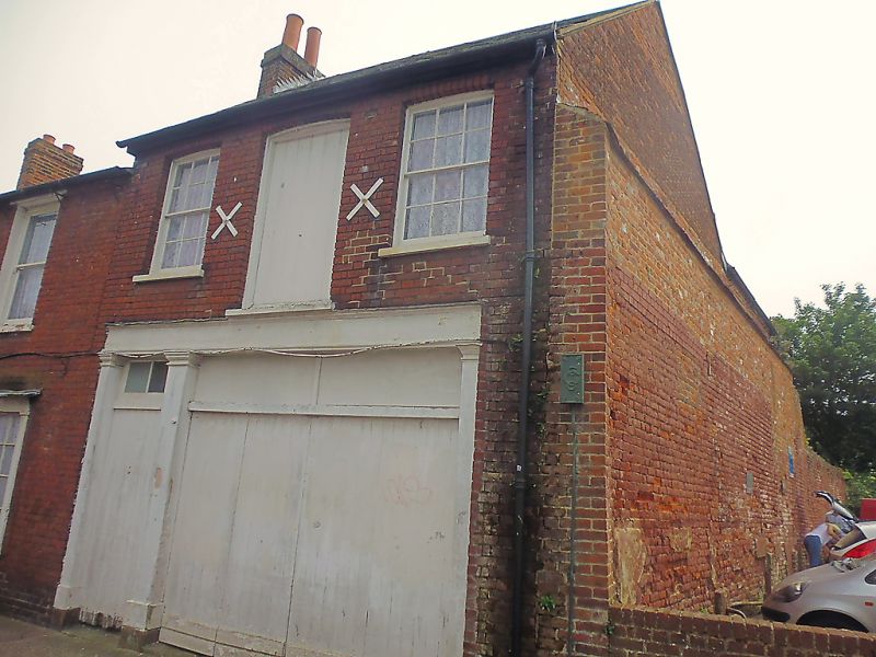
1.
944 IVY LANE
(South Side)
No 59A
TR 1557 NW 5/520
II GV
2.
Mid C19. 2 storeys red brick. Slate roof. 2 cambered sashes on first floor
and trap door. 2 braces. Ground floor has a carriage entrance and foot arch
with 3 plain pilasters and fanlight. Grade II for group value.
Nos 40A to 45 (consec), No 41, No 51A, Nos 53 to 61 (consec) and
No 63 form a group.
Listing NGR: TR1531657610
External links are from the relevant listing authority and, where applicable, Wikidata. Wikidata IDs may be related buildings as well as this specific building. If you want to add or update a link, you will need to do so by editing the Wikidata entry.


Other nearby listed buildings
