Approximate Location Map
Large Map »
Latitude: 51.2834 / 51°17'0"N
Longitude: 1.0689 / 1°4'7"E
OS Eastings: 614105
OS Northings: 158283
OS Grid: TR141582
Mapcode National: GBR TY2.F1K
Mapcode Global: VHLGM.G0XG
Plus Code: 9F3373M9+9G
Entry Name: 25 and 26, London Road
Listing Date: 7 September 1973
Grade: II
Source: Historic England
Source ID: 1241020
English Heritage Legacy ID: 439642
ID on this website: 101241020
Location: St Dunstan's, Canterbury, Kent, CT2
County: Kent
District: Canterbury
Electoral Ward/Division: Westgate
Parish: Non Civil Parish
Built-Up Area: Canterbury
Traditional County: Kent
Lieutenancy Area (Ceremonial County): Kent
Tagged with: Building
1.
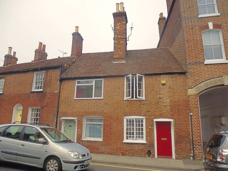
944 LONDON ROAD
(North West Side)
Nos 25 & 26
TR 1458 SW 1/540
II GV
2.
An C18 pair. 2 storeys red brick. Tiled roof. Mainly restored glazing. Only
the ground floor sliding sash to No 25 is original. Doorcases have sloping
weather hoods on brackets,
Nos 25 to 33 (consec) form a group.
Listing NGR: TR1410558287
External links are from the relevant listing authority and, where applicable, Wikidata. Wikidata IDs may be related buildings as well as this specific building. If you want to add or update a link, you will need to do so by editing the Wikidata entry.


Other nearby listed buildings
