Approximate Location Map
Large Map »
Latitude: 51.2837 / 51°17'1"N
Longitude: 1.0858 / 1°5'9"E
OS Eastings: 615289
OS Northings: 158361
OS Grid: TR152583
Mapcode National: GBR TY2.KB8
Mapcode Global: VHLGF.RZXT
Plus Code: 9F3373MP+F8
Entry Name: 32, Northgate
Listing Date: 7 September 1973
Grade: II
Source: Historic England
Source ID: 1241052
English Heritage Legacy ID: 439806
ID on this website: 101241052
Location: Northgate, Canterbury, Kent, CT1
County: Kent
District: Canterbury
Electoral Ward/Division: Northgate
Parish: Non Civil Parish
Built-Up Area: Canterbury
Traditional County: Kent
Lieutenancy Area (Ceremonial County): Kent
Tagged with: Building
1.
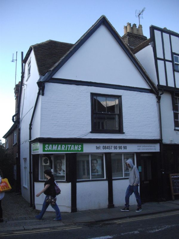
944 NORTHGATE
(North West Side)
No 32
TR 1558 SW 3/256
II GV
2.
A timber-framed building altered in the C18. 2 storeys painted brick. Gable.
Old tiled roof, 1 sash window. Early C19 shop front with pilasters.
Nos 28 to 37 (consec) form a group.
Listing NGR: TR1528458367
External links are from the relevant listing authority and, where applicable, Wikidata. Wikidata IDs may be related buildings as well as this specific building. If you want to add or update a link, you will need to do so by editing the Wikidata entry.


Other nearby listed buildings
