Approximate Location Map
Large Map »
Latitude: 51.2826 / 51°16'57"N
Longitude: 1.0766 / 1°4'35"E
OS Eastings: 614649
OS Northings: 158212
OS Grid: TR146582
Mapcode National: GBR TY2.H0S
Mapcode Global: VHLGM.M103
Plus Code: 9F3373MG+2J
Entry Name: 14 and 15, North Lane
Listing Date: 7 September 1973
Grade: II
Source: Historic England
Source ID: 1241136
English Heritage Legacy ID: 440063
ID on this website: 101241136
Location: Canterbury, Kent, CT2
County: Kent
District: Canterbury
Electoral Ward/Division: Westgate
Parish: Non Civil Parish
Built-Up Area: Canterbury
Traditional County: Kent
Lieutenancy Area (Ceremonial County): Kent
Tagged with: Building
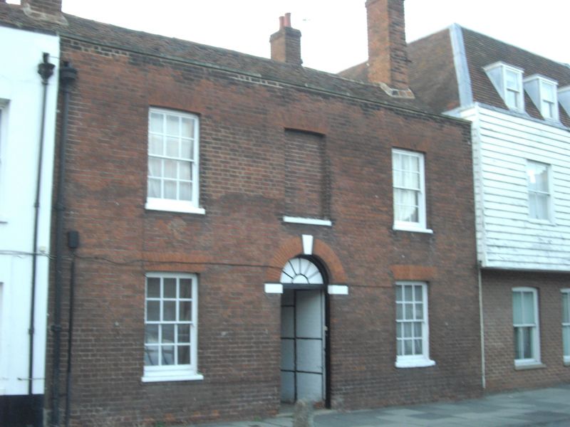
1.
944 NORTH LANE
(North West Side)
Nos 14 & 15
TR 1458 SE 2/346
II GV
2.
Late C18 to early C19 facade to a timber-framed building. 2 storeys red brick.
2 parallel ranges. Stone coping. 2 sashes with glazing bars intact and 1
blank. Central doorcase with curved pediment and 6 panelled door.
Nos 1, 2 & Nos 4 to 15 (consec) form a group.
Listing NGR: TR1464358214
External links are from the relevant listing authority and, where applicable, Wikidata. Wikidata IDs may be related buildings as well as this specific building. If you want to add or update a link, you will need to do so by editing the Wikidata entry.


Other nearby listed buildings
