Approximate Location Map
Large Map »
Latitude: 51.2028 / 51°12'10"N
Longitude: -0.5514 / 0°33'5"W
OS Eastings: 501300
OS Northings: 145844
OS Grid: TQ013458
Mapcode National: GBR FCY.KDT
Mapcode Global: VHFVV.D1C7
Plus Code: 9C3X6C3X+4C
Entry Name: Chinthurst Hill Tower
Listing Date: 28 October 1986
Grade: II
Source: Historic England
Source ID: 1241152
English Heritage Legacy ID: 440088
ID on this website: 101241152
Location: Wonersh, Waverley, Surrey, GU5
County: Surrey
District: Waverley
Civil Parish: Wonersh
Built-Up Area: Bramley
Traditional County: Surrey
Lieutenancy Area (Ceremonial County): Surrey
Church of England Parish: Wonersh with Blackheath
Church of England Diocese: Guildford
Tagged with: Tower
TQ 04NW WONERSH C.P. CHINTHURST LANE
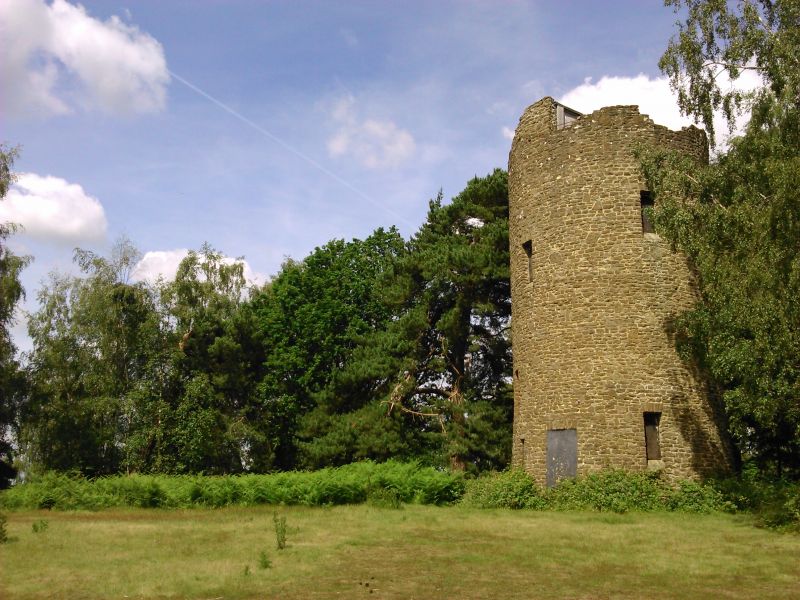
1/338 Chinthurst Hill
Tower
II
Tower. Late C19. Sandstone rubble, roughly coursed. Circular plan, approxi-
mately 15 feet in diameter. 20 feet high and battering to top. Roofless.
Single rectangular openings, the majority now boarded up. Door on east side.
Listing NGR: TQ0130045844
External links are from the relevant listing authority and, where applicable, Wikidata. Wikidata IDs may be related buildings as well as this specific building. If you want to add or update a link, you will need to do so by editing the Wikidata entry.


Other nearby listed buildings
