Approximate Location Map
Large Map »
Latitude: 51.2804 / 51°16'49"N
Longitude: 1.0798 / 1°4'47"E
OS Eastings: 614885
OS Northings: 157979
OS Grid: TR148579
Mapcode National: GBR TY2.PTP
Mapcode Global: VHLGM.N2QS
Plus Code: 9F3373JH+5W
Entry Name: 7, Orange Street
Listing Date: 3 May 1967
Grade: II
Source: Historic England
Source ID: 1241375
English Heritage Legacy ID: 440410
ID on this website: 101241375
Location: Canterbury, Kent, CT1
County: Kent
District: Canterbury
Electoral Ward/Division: Westgate
Parish: Non Civil Parish
Built-Up Area: Canterbury
Traditional County: Kent
Lieutenancy Area (Ceremonial County): Kent
Tagged with: Building
1.
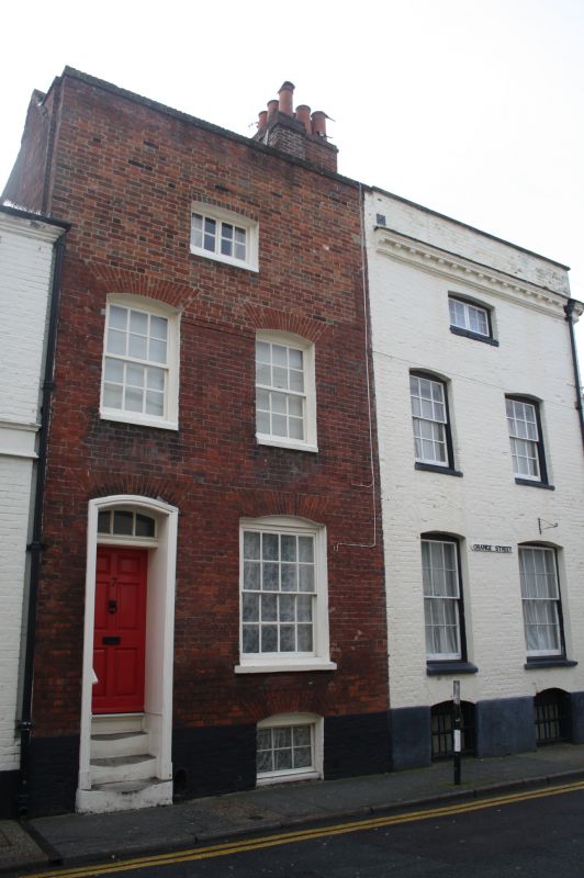
944 ORANGE STREET
(South East Side)
No 7
TR 1457 llE 4/275 3.5.67.
II GV
2.
Late C18. 2 storeys and basement red brick. Brick coping. 2 cambered recessed
sashes in moulded wooden architrave on 1st fioor. Ground floor has a left
side tall doorcase with cambered fanlight and 6 fielded panelled doors,
No 1 and Nos 4 to 7 (consec) form a group.
Listing NGR: TR1488457976
External links are from the relevant listing authority and, where applicable, Wikidata. Wikidata IDs may be related buildings as well as this specific building. If you want to add or update a link, you will need to do so by editing the Wikidata entry.


Other nearby listed buildings
