Approximate Location Map
Large Map »
Latitude: 51.2802 / 51°16'48"N
Longitude: 1.0805 / 1°4'49"E
OS Eastings: 614930
OS Northings: 157956
OS Grid: TR149579
Mapcode National: GBR TY2.PZ4
Mapcode Global: VHLGM.P21Y
Plus Code: 9F3373JJ+35
Entry Name: 19 and 19A, Orange Street
Listing Date: 7 September 1973
Grade: II
Source: Historic England
Source ID: 1241381
English Heritage Legacy ID: 440417
ID on this website: 101241381
Location: Canterbury, Kent, CT1
County: Kent
District: Canterbury
Electoral Ward/Division: Westgate
Parish: Non Civil Parish
Built-Up Area: Canterbury
Traditional County: Kent
Lieutenancy Area (Ceremonial County): Kent
Tagged with: Building
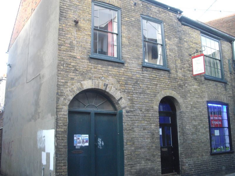
1.
944 ORANGE STREET
(North West Side)
Nos 19 and 19A
TR 1457 NE 4/628
II GV
2.
Cl8. 2 storeys buff brick. Old tiled roof. 3 sashes with some glazing bars
intact. Ground floor has 2 doorcases, one with a recessed elliptical fanlight,
the other round-headed.
Nos 9, 20, Nos 13 to 17 (consec) and Nos 19, 19A and 20 form a group.
Listing NGR: TR1490357980
External links are from the relevant listing authority and, where applicable, Wikidata. Wikidata IDs may be related buildings as well as this specific building. If you want to add or update a link, you will need to do so by editing the Wikidata entry.


Other nearby listed buildings
