Approximate Location Map
Large Map »
Latitude: 51.2811 / 51°16'52"N
Longitude: 1.075 / 1°4'29"E
OS Eastings: 614542
OS Northings: 158045
OS Grid: TR145580
Mapcode National: GBR TY2.NKR
Mapcode Global: VHLGM.L246
Plus Code: 9F3373JF+FX
Entry Name: Arch in Grounds of Tower House to North East of the House
Listing Date: 3 May 1967
Grade: II
Source: Historic England
Source ID: 1241662
English Heritage Legacy ID: 440840
ID on this website: 101241662
Location: Westgate Gardens, Canterbury, Kent, CT2
County: Kent
District: Canterbury
Electoral Ward/Division: Westgate
Parish: Non Civil Parish
Built-Up Area: Canterbury
Traditional County: Kent
Lieutenancy Area (Ceremonial County): Kent
Tagged with: Arch
1.
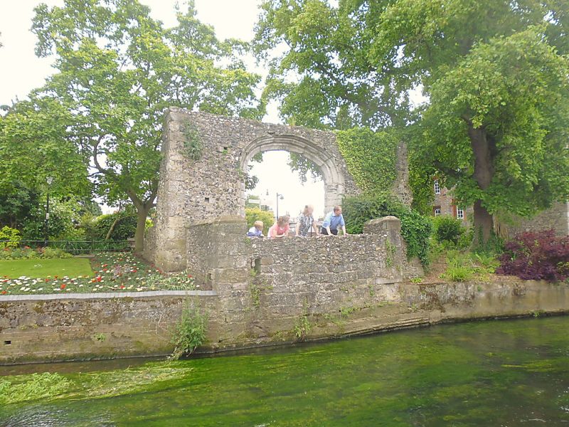
944 ST DUNSTAN'S STREET
Arch in grounds of
Tower House, to north east
of the house
TR 1458 SE 2/648 3.5.67.
II
2.
Mediaeval. Set in a flint and rubble wall with stone quoins. Stone 4 centred
arch with moulded capitals.
Listing NGR: TR1454258045
External links are from the relevant listing authority and, where applicable, Wikidata. Wikidata IDs may be related buildings as well as this specific building. If you want to add or update a link, you will need to do so by editing the Wikidata entry.


Other nearby listed buildings
