Approximate Location Map
Large Map »
Latitude: 51.2775 / 51°16'38"N
Longitude: 1.093 / 1°5'34"E
OS Eastings: 615815
OS Northings: 157692
OS Grid: TR158576
Mapcode National: GBR TY3.TBQ
Mapcode Global: VHLGM.W5P0
Plus Code: 9F3373GV+X5
Entry Name: 3 and 5, St Martin's Hill
Listing Date: 7 September 1973
Grade: II
Source: Historic England
Source ID: 1242225
English Heritage Legacy ID: 441528
ID on this website: 101242225
Location: St Martin's, Canterbury, Kent, CT1
County: Kent
District: Canterbury
Electoral Ward/Division: Barton
Parish: Non Civil Parish
Built-Up Area: Canterbury
Traditional County: Kent
Lieutenancy Area (Ceremonial County): Kent
Tagged with: Building
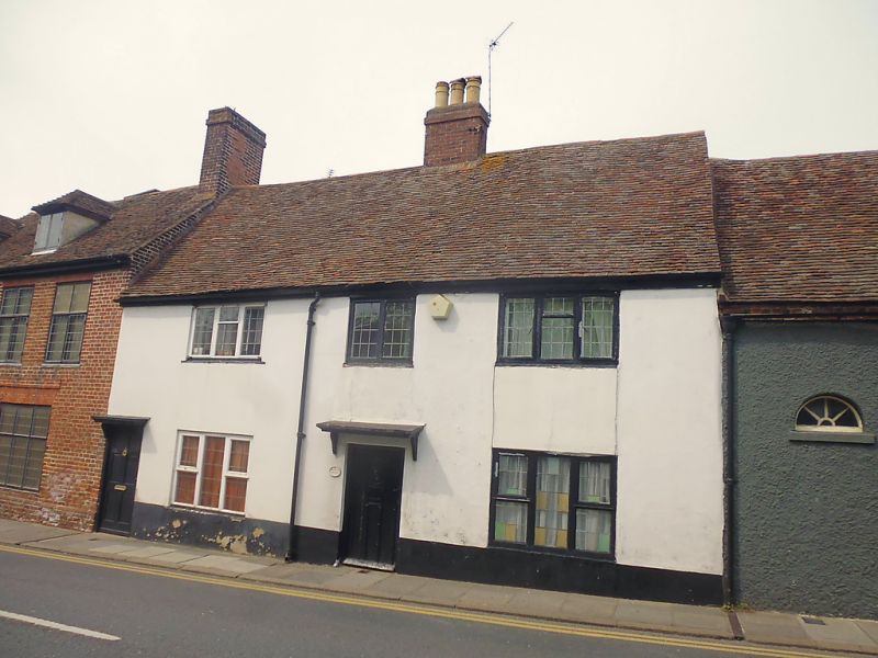
1.
944 ST MARTIN'S HILL
Nos 3 & 5
TR 1557 NE 6/669
II GV
2. Probably C17, restored. 2 storeys stuccoed. Old tiled roof with 3 restored
casements. 2 modern doorcases.
Nos 1 to 13 (odd) form a group.
Listing NGR: TR1581357695
External links are from the relevant listing authority and, where applicable, Wikidata. Wikidata IDs may be related buildings as well as this specific building. If you want to add or update a link, you will need to do so by editing the Wikidata entry.


Other nearby listed buildings
