Approximate Location Map
Large Map »
Latitude: 51.2803 / 51°16'49"N
Longitude: 1.078 / 1°4'40"E
OS Eastings: 614759
OS Northings: 157967
OS Grid: TR147579
Mapcode National: GBR TY2.PCF
Mapcode Global: VHLGM.M2RT
Plus Code: 9F3373JH+46
Entry Name: 7 AND 7A, St PETER'S STREET (See details for further address information)
Listing Date: 7 September 1973
Grade: II
Source: Historic England
Source ID: 1242341
English Heritage Legacy ID: 441705
ID on this website: 101242341
Location: Canterbury, Kent, CT1
County: Kent
District: Canterbury
Electoral Ward/Division: Westgate
Parish: Non Civil Parish
Built-Up Area: Canterbury
Traditional County: Kent
Lieutenancy Area (Ceremonial County): Kent
Tagged with: Building
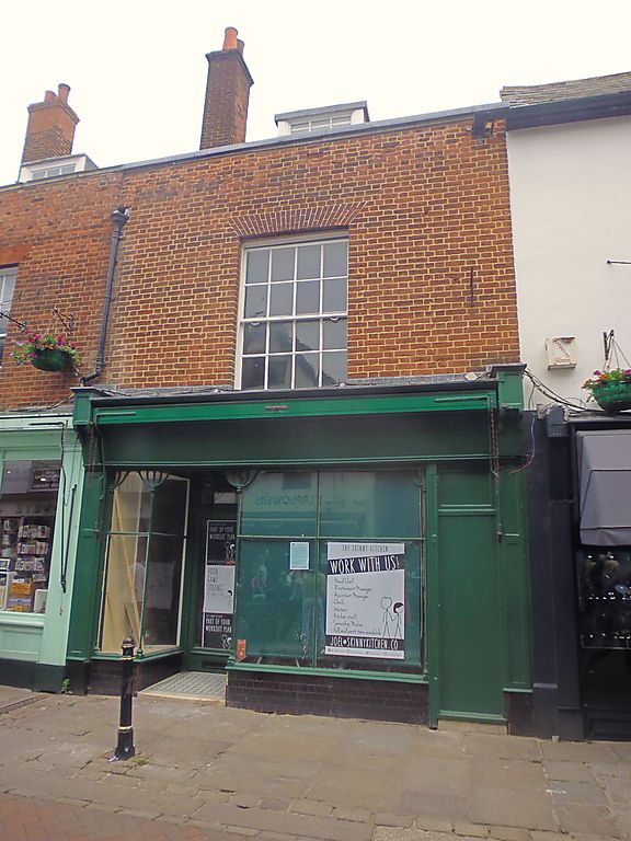
1.
944 ST PETER'S STREET
(North East Side)
Nos 7 and 7A
No 8
TR 1457 NE 4/679
II GV
2.
Early C18 restored. 2 storeys red brick. Stone coping. Old tiled roof with
3 dormers. 2 sashes with glazing bars intact. 1 C19 sash. Later shop fronts.
Nos 1 to 10 (consec) form a group.
Listing NGR: TR1475757971
External links are from the relevant listing authority and, where applicable, Wikidata. Wikidata IDs may be related buildings as well as this specific building. If you want to add or update a link, you will need to do so by editing the Wikidata entry.


Other nearby listed buildings
