Approximate Location Map
Large Map »
Latitude: 52.1536 / 52°9'12"N
Longitude: -2.1806 / 2°10'50"W
OS Eastings: 387742
OS Northings: 250601
OS Grid: SO877506
Mapcode National: GBR 1GL.TTJ
Mapcode Global: VH931.542F
Plus Code: 9C4V5R39+CQ
Entry Name: Norton Grange
Listing Date: 3 August 1972
Grade: II
Source: Historic England
Source ID: 1242859
English Heritage Legacy ID: 443827
ID on this website: 101242859
Location: Hatfield, Wychavon, Worcestershire, WR5
County: Worcestershire
District: Wychavon
Civil Parish: Norton Juxta Kempsey
Traditional County: Worcestershire
Lieutenancy Area (Ceremonial County): Worcestershire
Church of England Parish: Norton
Church of England Diocese: Worcester
Tagged with: Building
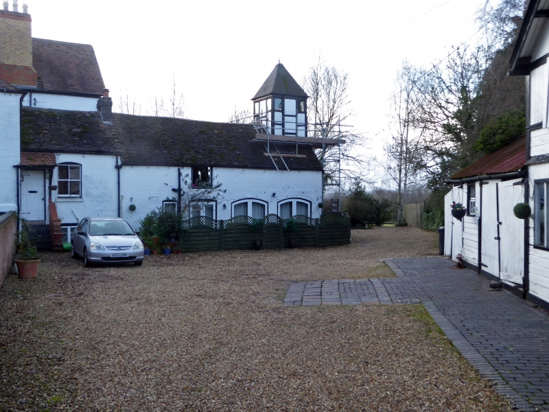
NORTON-JUXTA-KEMPSEY NORTON
1.
2301
Norton Grange
SO 85 SE 4/536
II
2.
C17. Timber frame and brick nucleus with large gabled wing. Substantial
alterations and additions. 2-storeys. Modern casements. Machine tile roof.
Listing NGR: SO8774250601
External links are from the relevant listing authority and, where applicable, Wikidata. Wikidata IDs may be related buildings as well as this specific building. If you want to add or update a link, you will need to do so by editing the Wikidata entry.


Other nearby listed buildings
