Approximate Location Map
Large Map »
Latitude: 51.4229 / 51°25'22"N
Longitude: -1.7273 / 1°43'38"W
OS Eastings: 419055
OS Northings: 169358
OS Grid: SU190693
Mapcode National: GBR 4X2.N44
Mapcode Global: VHC1P.0HPK
Plus Code: 9C3WC7FF+53
Entry Name: 6 and 7, Saint Martins
Listing Date: 21 October 1974
Grade: II
Source: Historic England
Source ID: 1243231
English Heritage Legacy ID: 446879
ID on this website: 101243231
Location: Marlborough, Wiltshire, SN8
County: Wiltshire
Civil Parish: Marlborough
Built-Up Area: Marlborough
Traditional County: Wiltshire
Lieutenancy Area (Ceremonial County): Wiltshire
Tagged with: Building
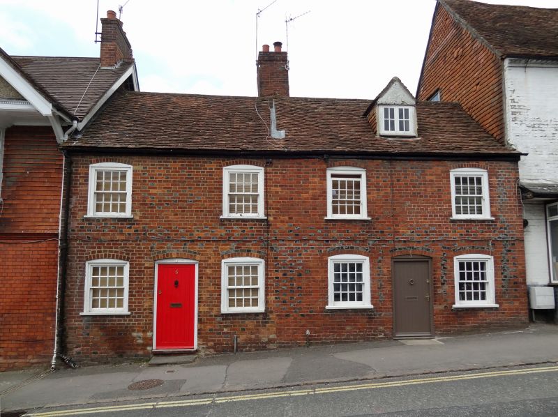
SAINT MARTINS
1.
5407
(North Side)
Nos 6 and 7
SU 1969 1/295
II GV
2.
C18. Red brick with grey headers. Pitched old tile roof. Brick stack. 2 storeys
and attics. 4 ranges of segment-headed sashes with original glazing bars in
flush-framed cases. 2 modern doors in segment-headed openings. No 7 has 1
attic dormer with casement.
Nos 6 to 28 (consec) form a group.
Listing NGR: SU1905469359
External links are from the relevant listing authority and, where applicable, Wikidata. Wikidata IDs may be related buildings as well as this specific building. If you want to add or update a link, you will need to do so by editing the Wikidata entry.


Other nearby listed buildings
