Approximate Location Map
Large Map »
Latitude: 51.0877 / 51°5'15"N
Longitude: -0.7125 / 0°42'44"W
OS Eastings: 490270
OS Northings: 132835
OS Grid: SU902328
Mapcode National: GBR DCS.LPP
Mapcode Global: FRA 96D7.VMM
Plus Code: 9C3X37QQ+32
Entry Name: 33, Shepherds Hill
Listing Date: 19 September 1977
Grade: II
Source: Historic England
Source ID: 1244478
English Heritage Legacy ID: 449572
ID on this website: 101244478
Location: Haslemere, Waverley, Surrey, GU27
County: Surrey
District: Waverley
Civil Parish: Haslemere
Built-Up Area: Haslemere
Traditional County: Surrey
Lieutenancy Area (Ceremonial County): Surrey
Church of England Parish: Haslemere
Church of England Diocese: Guildford
Tagged with: Building
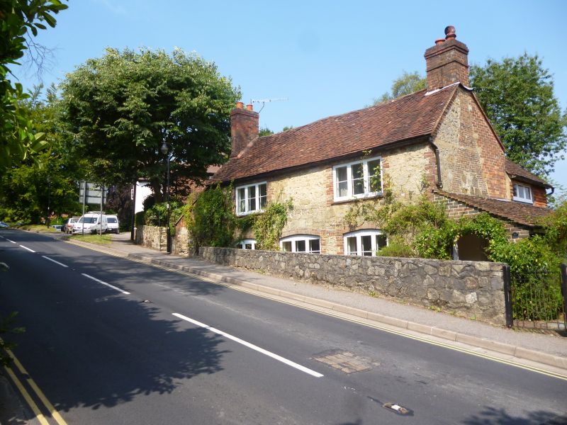
SHEPHERD'S HILL
1.
5393
(North Side)
No 33
SU 9032 NW 3/172
II GV
2.
C18 house of 2 storeys, 3 bays. No 1st floor centre window. Random malmstone
of varying size, red brick dressings with some blue headers. Tiled roof with end
chimneys. Lean-to at left part rubble, part brick, also rear extensions. C19
one-bar casements under segmental brick arches. Pent porch at right.
Listing NGR: SU9026832836
External links are from the relevant listing authority and, where applicable, Wikidata. Wikidata IDs may be related buildings as well as this specific building. If you want to add or update a link, you will need to do so by editing the Wikidata entry.


Other nearby listed buildings
