Approximate Location Map
Large Map »
Latitude: 51.8377 / 51°50'15"N
Longitude: -2.2724 / 2°16'20"W
OS Eastings: 381330
OS Northings: 215486
OS Grid: SO813154
Mapcode National: GBR 0K0.NBS
Mapcode Global: VH94J.K2KK
Plus Code: 9C3VRPQH+33
Entry Name: Milepost at Ngr So 813 155
Listing Date: 30 November 1989
Grade: II
Source: Historic England
Source ID: 1245823
English Heritage Legacy ID: 472216
ID on this website: 101245823
Location: Gloucester, Gloucestershire, GL2
County: Gloucestershire
District: Gloucester
Electoral Ward/Division: Westgate
Parish: Non Civil Parish
Built-Up Area: Gloucester
Traditional County: Gloucestershire
Lieutenancy Area (Ceremonial County): Gloucestershire
Church of England Parish: Quedgeley
Church of England Diocese: Gloucester
Tagged with: Milestone
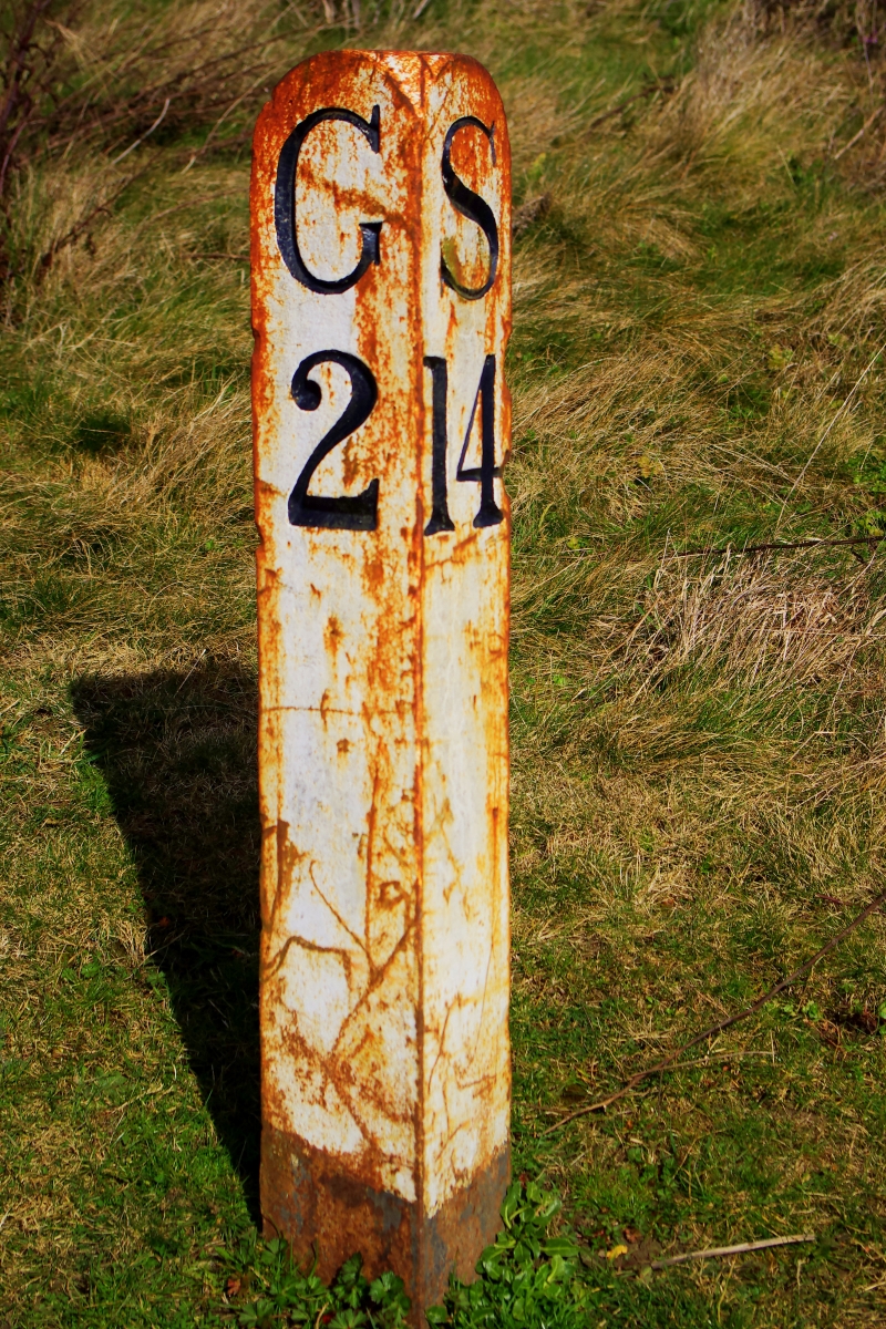
GLOUCESTER
SO81NW GLOUCESTER AND SHARPNESS CANAL
844-1/3/127 Milepost at NGR SO 813 155
30/11/89
II
Canal mile post. 1827. Painted, triangular, stone post with
rounded top. Incised serif lettering and numbers: on left
face,"G2" on right face,"S14".
Listing NGR: SO8130015500
External links are from the relevant listing authority and, where applicable, Wikidata. Wikidata IDs may be related buildings as well as this specific building. If you want to add or update a link, you will need to do so by editing the Wikidata entry.


Other nearby listed buildings
