Approximate Location Map
Large Map »
Latitude: 51.1962 / 51°11'46"N
Longitude: 1.3383 / 1°20'17"E
OS Eastings: 633333
OS Northings: 149411
OS Grid: TR333494
Mapcode National: GBR X21.WQV
Mapcode Global: VHLH5.46W9
Plus Code: 9F3358WQ+F8
Entry Name: Upper Farm
Listing Date: 24 March 1987
Grade: II
Source: Historic England
Source ID: 1247666
English Heritage Legacy ID: 428203
ID on this website: 101247666
Location: Sutton, Dover, Kent, CT15
County: Kent
District: Dover
Civil Parish: Sutton
Traditional County: Kent
Lieutenancy Area (Ceremonial County): Kent
Tagged with: Agricultural structure
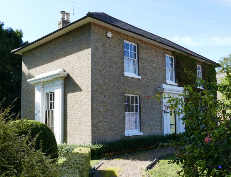
SUTTON CHURCH HILL
TR 34 NW (West side)
7/88 Upper Farm
II
House. Circa 1830. Yellow brick and slate roof. Two storeys and hipped
roof with wide overhanging eaves, and stacks to left and to right. Regular
fenestration of 3 glazing bar sashes on first floor and 2 on ground floor.
Central door of 6 panels in large rendered door surround with doubled
pilasters supporting large frieze. Similar but larger surround on left
return to garden window.
Listing NGR: TR3333349411
External links are from the relevant listing authority and, where applicable, Wikidata. Wikidata IDs may be related buildings as well as this specific building. If you want to add or update a link, you will need to do so by editing the Wikidata entry.


Other nearby listed buildings
