Approximate Location Map
Large Map »
Latitude: 52.9248 / 52°55'29"N
Longitude: -1.2173 / 1°13'2"W
OS Eastings: 452716
OS Northings: 336662
OS Grid: SK527366
Mapcode National: GBR 8HV.R1C
Mapcode Global: WHDGY.8RL4
Plus Code: 9C4WWQFM+W3
Entry Name: The Grange
Listing Date: 11 May 1976
Grade: II
Source: Historic England
Source ID: 1247918
English Heritage Legacy ID: 429326
Also known as: The Grange, Beeston
Beeston Police Station
ID on this website: 101247918
Location: Beeston, Broxtowe, Nottinghamshire, NG9
County: Nottinghamshire
District: Broxtowe
Electoral Ward/Division: Beeston West
Parish: Non Civil Parish
Built-Up Area: Beeston (Broxtowe)
Traditional County: Nottinghamshire
Lieutenancy Area (Ceremonial County): Nottinghamshire
Church of England Parish: Beeston
Church of England Diocese: Southwell and Nottingham
Tagged with: Building
SK 5236 NE BEESTON AND STAPLEFORD CHILWELL ROAD
(south east side)
6/5
The Grange
11.5.76
II
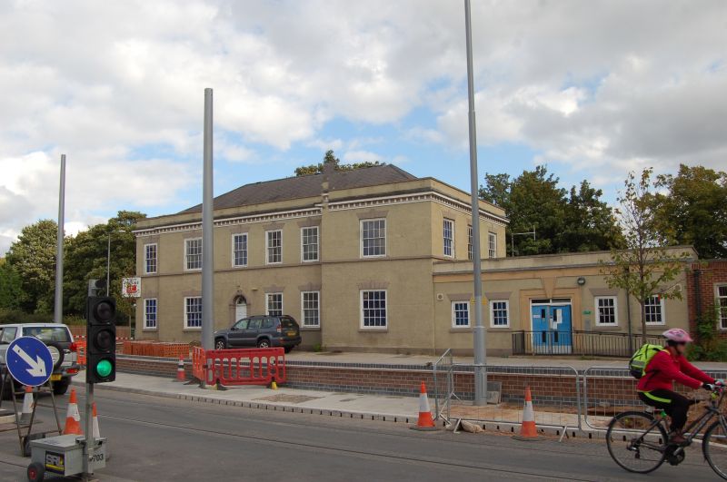
House. Now a police station. c.1820. Extended mid C19. Brick,
colourwashed, with hipped slate roof. Stone plinth, first floor
band, panelled eaves and parapet. 2 storeys plus attics, 5
unequal bays, square plan. Windows are mainly glazing bar sashes
of various sizes, with multiple keystoned lintels. Front has
setback addition to left and projecting wing to right. Off-
centre reeded doorcase with palemtte keystone and iron fanlight.
Flanked by 2 sashes. Beyond, to right, a single sash. Rear has
off-centre 2 storey canted bay window with 3 sashes on each
floor. Flanked to left by a tall sash and to right by doorcase
similar to front. To right, 2 sashes. Above, to left, a sash,
and to right, 3 sashes. West end has adjoining addition, late
C20, and to right, a sash. Above, 3 sashes. Interior has
Classical foliate plaster cornice and ceiling rose. This
building was formerly used as a homeless persons hostel.
Listing NGR: SK5271636662
External links are from the relevant listing authority and, where applicable, Wikidata. Wikidata IDs may be related buildings as well as this specific building. If you want to add or update a link, you will need to do so by editing the Wikidata entry.


Other nearby listed buildings
