Approximate Location Map
Large Map »
Latitude: 53.1085 / 53°6'30"N
Longitude: -1.5561 / 1°33'21"W
OS Eastings: 429816
OS Northings: 356901
OS Grid: SK298569
Mapcode National: GBR 599.3DR
Mapcode Global: WHCDW.2499
Plus Code: 9C5W4C5V+9H
Entry Name: The Shrubbery
Listing Date: 22 June 1950
Grade: II
Source: Historic England
Source ID: 1248011
English Heritage Legacy ID: 429507
ID on this website: 101248011
Location: Cromford, Derbyshire Dales, Derbyshire, DE4
County: Derbyshire
District: Derbyshire Dales
Civil Parish: Cromford
Built-Up Area: Cromford
Traditional County: Derbyshire
Lieutenancy Area (Ceremonial County): Derbyshire
Church of England Parish: Cromford St Mary
Church of England Diocese: Derby
Tagged with: Architectural structure
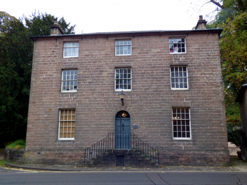
1. MILL ROAD
159O CROMFORD
The Shrubbery
SK 2956 1/15 22.6.5O.
II
2,
Circa 1771. Originally the mill-manager's house. Ashlar; 3 storeys; 3
sash windows; segmental-headed recessed doorway; plain eaves; slates.
Stepped perron with good iron railings and scrolled lamp bracket.
Listing NGR: SK2981656901
External links are from the relevant listing authority and, where applicable, Wikidata. Wikidata IDs may be related buildings as well as this specific building. If you want to add or update a link, you will need to do so by editing the Wikidata entry.


Other nearby listed buildings
