Approximate Location Map
Large Map »
Latitude: 52.2436 / 52°14'36"N
Longitude: 0.7153 / 0°42'55"E
OS Eastings: 585477
OS Northings: 264071
OS Grid: TL854640
Mapcode National: GBR QF0.7NF
Mapcode Global: VHKD4.CV0Y
Plus Code: 9F426PV8+C4
Entry Name: 30, Churchgate Street
Listing Date: 12 July 1972
Grade: II
Source: Historic England
Source ID: 1248122
English Heritage Legacy ID: 466711
ID on this website: 101248122
Location: Bury St Edmunds, West Suffolk, IP33
County: Suffolk
District: West Suffolk
Civil Parish: Bury St Edmunds
Built-Up Area: Bury St Edmunds
Traditional County: Suffolk
Lieutenancy Area (Ceremonial County): Suffolk
Church of England Parish: Bury St Edmunds St Mary
Church of England Diocese: St.Edmundsbury and Ipswich
Tagged with: Building
BURY ST EDMUNDS
TL8564SW CHURCHGATE STREET
639-1/14/244 (North side)
12/07/72 No.30
GV II
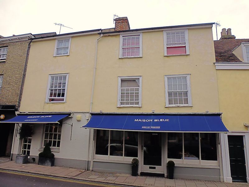
House, now a shop with flat above. C16 front range, raised and
fronted in the early C19; C17 rear extension. Timber-framed,
with old roughcast render; painted brick to the ground storey;
slate roof with plain eaves soffit.
EXTERIOR: 3 storeys and cellar. One window to each storey: a
16-pane sash in a heavy, slightly projecting cased frame to
the 1st storey and a smaller sash in a similar frame with a
single vertical bar to lights to the top storey. The ground
storey has a 16-pane sash in plain reveals with a stone sill.
A C20 small-paned entrance door on the left in a semicircular
brick arched opening has an original fanlight over with
tracery in 3 intersecting circles. A wide gable to the rear
range, which is shared with No.31 (qv) adjoining.
INTERIOR: the cellar, which also extends into No.31, has
walling of rough squared stone blocks and a replaced timber
ceiling with a large re-used main beam. On the ground storey
the studding of the rear wall of the front range has been
exposed and the infill removed: the studding is substantial,
most of it re-used; one stud was part of a wallplate, with
housings for the rafter-ends.
Listing NGR: TL8547964096
External links are from the relevant listing authority and, where applicable, Wikidata. Wikidata IDs may be related buildings as well as this specific building. If you want to add or update a link, you will need to do so by editing the Wikidata entry.


Other nearby listed buildings
